alb2005059
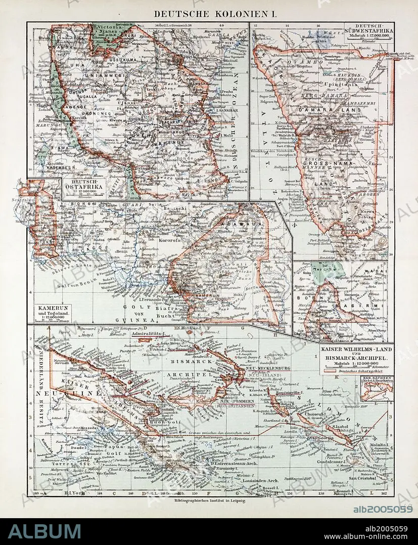
MAP OF GERMAN COLONIES, GERMAN NEW GUINEA, CAMEROON, 1899.
| Share |
|---|
 Pinterest Pinterest |
 Twitter Twitter |
 Facebook Facebook |
 Copy link Copy link |
 Email Email |
|
Add to another lightbox |
|
Add to another lightbox |


Buy this image.
Select the use:

Caption: MAP OF GERMAN COLONIES, GERMAN NEW GUINEA, CAMEROON, 1899
Credit: Album / quintlox
Releases: ? Model Release: No - ? Property Release: No
Rights questions?
Rights questions?
Image size: 4905 × 6074 px | 85.2 MB
Print size: 41.5 × 51.4 cm | 1931.1 × 2391.3 in (300 dpi)
Keywords: 1899 • CAMEROON • COLONIES • GERMAN NEW GUINEA • GERMAN • GERMANS • MAP • MAPS • NINETEENTH CENTURY MAP • PLAN (CARTOGRAPHY)
