alb2216985
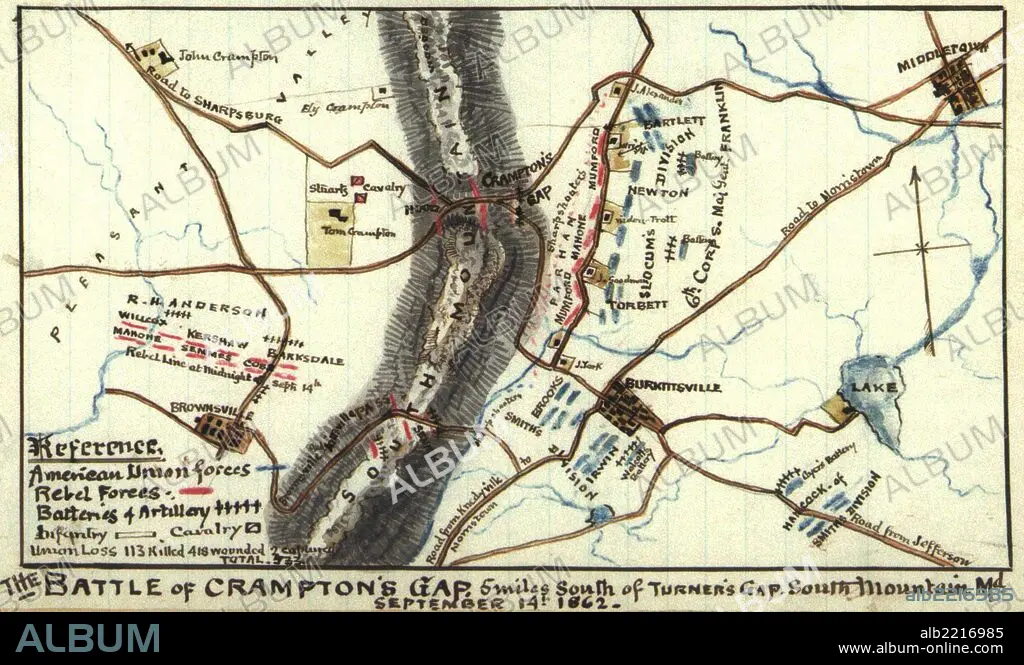
Battle of Crampton's Gap: 5 miles south of Turner's Gap, South Mountain, Md. 1862
| Share |
|---|
 Pinterest Pinterest |
 Twitter Twitter |
 Facebook Facebook |
 Copy link Copy link |
 Email Email |
|
Add to another lightbox |
|
Add to another lightbox |


Title:
Battle of Crampton's Gap: 5 miles south of Turner's Gap, South Mountain, Md. 1862
Caption:
Battle of Crampton's Gap : 5 miles south of Turner's Gap, South Mountain, Md. September 14th 1862.
Credit:
Album / Universal Images Group / Universal History Archive/UIG
Releases:
Model: No - Property: No
Rights questions?
Rights questions?
Image size:
2976 x 1779 px | 15.1 MB
Print size:
25.2 x 15.1 cm | 9.9 x 5.9 in (300 dpi)
Keywords:
1862 • 9 MILE ROAD • ARMIES ARMY • ARMIES • ARMY • CARTOGRAPHIC • CARTOGRAPHY • CHICKAHOMINY • CIVIL • FAIR OAKS • FÉDÉRAL • HAND COLORED • HUNDRED YEARS WAR • JOHNSTON • MAP MAKING • MAP • MAPS • MCCLELLAN • NORDEN • NORTH • PLAN (CARTOGRAPHY) • POTOMAC • RAILROAD • RAILWAY • SEVEN PINES • SUMNER • UNION • WAR • WARFARE • WILLIAMSBURG • YORK RIVER
