alb1651579
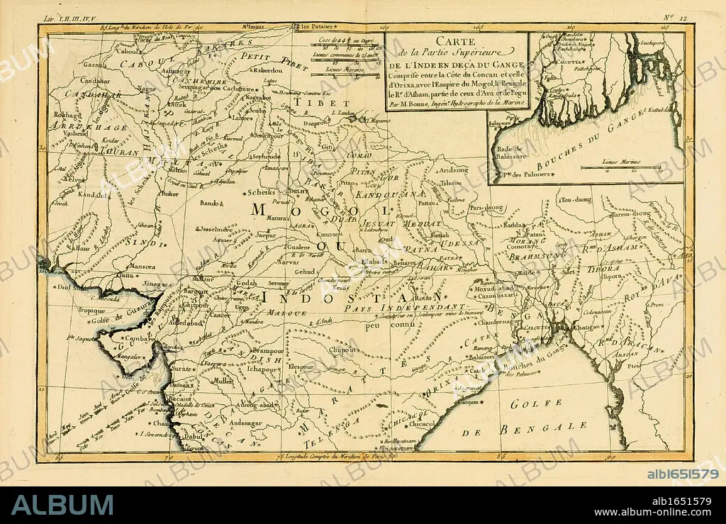
Map of Northern India, circa.1760. From 'Atlas de Toutes Les Parties Connues du Globe Terrestre ' by Cartographer Rigobert Bonne. Published Geneva circa. 1760.
| Share |
|---|
 Pinterest Pinterest |
 Twitter Twitter |
 Facebook Facebook |
 Copy link Copy link |
 Email Email |
|
Add to another lightbox |
|
Add to another lightbox |


Buy this image.
Select the use:

Caption: Map of Northern India, circa.1760. From 'Atlas de Toutes Les Parties Connues du Globe Terrestre ' by Cartographer Rigobert Bonne. Published Geneva circa. 1760.
Category: UIG HISTORY
Credit: Album / Universal History Archive/Universal Images Group
Releases: ? Model Release: No - ? Property Release: No
Rights questions?
Rights questions?
Image size: 5539 × 3711 px | 58.8 MB
Print size: 46.9 × 31.4 cm | 2180.7 × 1461.0 in (300 dpi)
Keywords: CARTOGRAPHY • COLOR • COLOUR • DISH • ENGRAVED • ENGRAVING (ARTWORK) • ENGRAVING • ENGRAVING. • ENGRAVINGS • ETCHING • FLUSH • GEOGRAFIA • GEOGRAPHY • HORIZONTAL • ILLUSTRATION • ILLUSTRATIONS • ILUSTRATION • INDIA • KEN • MAP MAKING • MAP • MAPMAKING • MAPS • NORTHERN • PLAN (CARTOGRAPHY) • PLATE • PRINT • UIG HISTORY • WELSH
