alb4064644
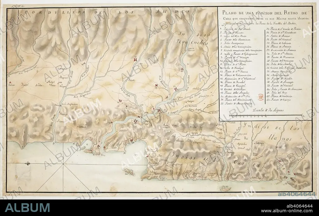
Map of Concepcion and surrounding area, in Chile, orientated with East at the top, with scale, three and a half leagues to an inch, and a key. Plano de una Porcion del Reino de Chile. 18th century. Source: Add. 17675 E. Language: Spanish.
| Share |
|---|
 Pinterest Pinterest |
 Twitter Twitter |
 Facebook Facebook |
 Copy link Copy link |
 Email Email |
|
Add to another lightbox |
|
Add to another lightbox |


Buy this image.
Select the use:

Caption: Map of Concepcion and surrounding area, in Chile, orientated with East at the top, with scale, three and a half leagues to an inch, and a key. Plano de una Porcion del Reino de Chile. 18th century. Source: Add. 17675 E. Language: Spanish.
Credit: Album / British Library
Releases: ? Model Release: No - ? Property Release: No
Rights questions?
Rights questions?
Image size: 8858 × 5538 px | 140.3 MB
Print size: 75.0 × 46.9 cm | 3487.4 × 2180.3 in (300 dpi)
Keywords: 18TH CENTURY • 18TH CENTURY, THE • 18TH CENTURY. • 18TH • ARCHIVE • ARCHIVES • CARTE • CARTOGRAPHIC • CARTOGRAPHY • CHILE • DOCUMENT • LATIN AMERICA • LATIN AMERICAN • LATINOAMERICA • MANUSCRIPT • MAP MAKING • MAP • MAPS • PLAN (CARTOGRAPHY) • SOUTH AMERICA • SUDAMERICA • XVIII CENTURY
