alb3357281
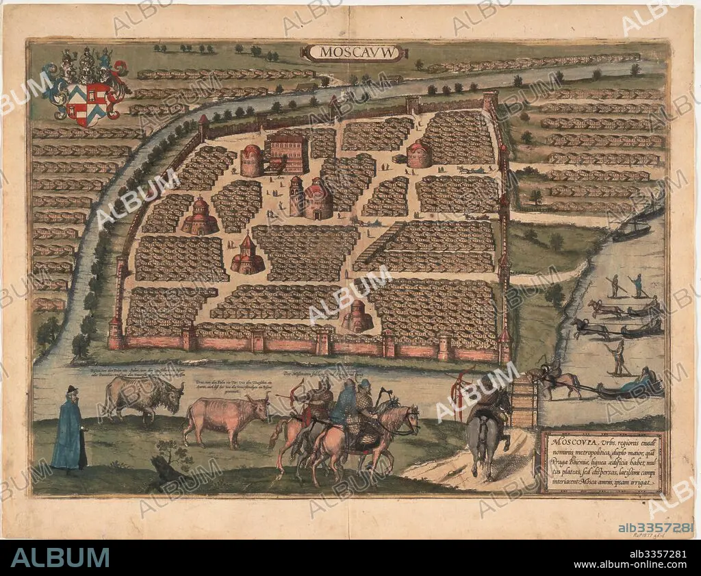
FRANS HOGENBERG. Map of Moscow of the 16th century (From: Civitates orbis terrarium).
| Share |
|---|
 Pinterest Pinterest |
 Twitter Twitter |
 Facebook Facebook |
 Copy link Copy link |
 Email Email |
|
Add to another lightbox |
|
Add to another lightbox |


Caption:
Map of Moscow of the 16th century (From: Civitates orbis terrarium)
Personalities:
Technique/material:
Copper engraving, watercolour
Museum:
PRIVATE COLLECTION
Credit:
Album / Fine Art Images
Releases:
Model: No - Property: No
Rights questions?
Rights questions?
Image size:
5315 x 4089 px | 62.2 MB
Print size:
45.0 x 34.6 cm | 17.7 x 13.6 in (300 dpi)
Keywords:
ARCHITECTURE • CARTOGRAPHY • CASTELLUM URBIS MOSKVAE • COPPER ENGRAVING, WATERCOLOUR • EARLY RUS • FLANDERS • GRAND DUCHY OF MOSCOW • GRAPHIC ARTS • HISTORY OF RUSSIA • HISTORY • HOGENBERG, FRANS • INTERIOR • KREMLEN-GRAD • KREMLENAGRAD • KREMLIN • MAP MAKING • MAP • MIDDLE AGES • MOSCOW PRINCIPALITY • MOSCOW • MUSCOVY • PLAN • PRIVATE COLLECTION • RUSIA • RUSSIA • RUSSIAN HISTORY
