alb3822980
Map of Europe, 1600
| Share |
|---|
 Pinterest Pinterest |
 Twitter Twitter |
 Facebook Facebook |
 Copy link Copy link |
 Email Email |
|
Add to another lightbox |
|
Add to another lightbox |


Buy this image.
Select the use:

Title:
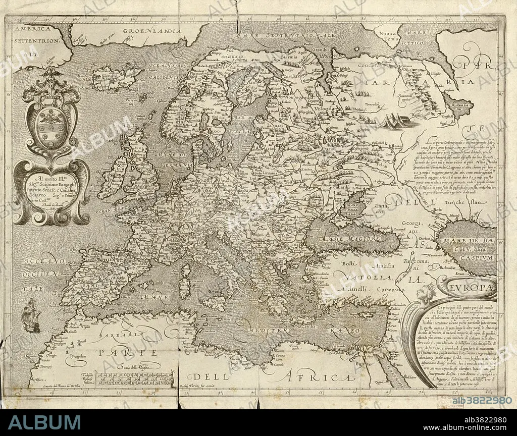
Map of Europe, 1600
Caption:
16th century map of Europe. Published in Sienna in 1600, this Italian map shows the latest knowledge of the geography of Europe. The writing is in Italian, and a dedication is given at upper left in a cartouche, along with the name of the cartographer, Arnoldo di Arnoldi (died 1602). Notes are given at far right, with the title at lower right. A scale bar is at lower left.
Credit:
Album / Science Source / LOC/Geography and Map Division
Releases:
Model: No - Property: No
Rights questions?
Rights questions?
Image size:
5998 x 4753 px | 81.6 MB
Print size:
50.8 x 40.2 cm | 20.0 x 15.8 in (300 dpi)
Keywords:
1500S • 16 16TH XVI XVITH SIXTEENTH CENTURY • 16 CENTURY • 1600 • 1600S • 16TH CENTURY • 16TH • 17TH CENTURY • ARNOLDO DI ARNOLDI • CARTOGRAPHY • EUROPE • EUROPEA • EUROPEAN • EUROPEANS • EXPLORATION • GEOGRAFIA • GEOGRAPHICAL • GEOGRAPHY • HISTORICAL • HISTORY • HORIZONTAL • ITALIAN • MAP MAKING • MAP • MEDIEVAL • MIDDLE AGES • OLD • XVI CENTURY
