alb5406767
Territorial Acquisitions of United States, Map
| Share |
|---|
 Pinterest Pinterest |
 Twitter Twitter |
 Facebook Facebook |
 Copy link Copy link |
 Email Email |
|
Add to another lightbox |
|
Add to another lightbox |


Buy this image.
Select the use:

Title:
Territorial Acquisitions of United States, Map
Caption:
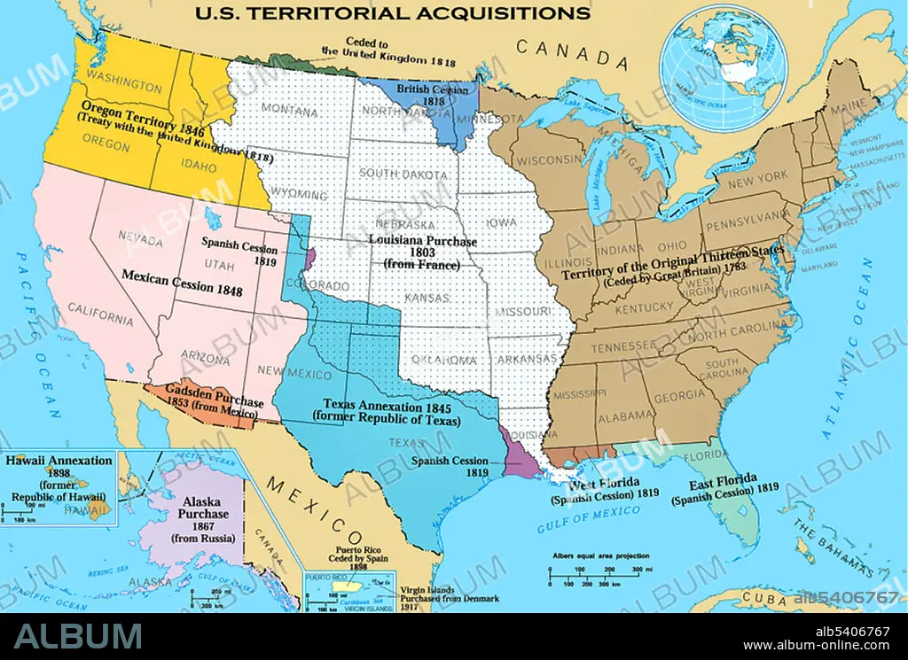
Territorial acquisitions of the United States, such as the Thirteen Colonies, the Louisiana Purchase, and the British and Spanish Cession.
Credit:
Album / Science Source
Releases:
Image size:
2520 x 1703 px | 12.3 MB
Print size:
21.3 x 14.4 cm | 8.4 x 5.7 in (300 dpi)
Keywords:
19TH CENTURY • ACQUISITIONS • ALASKA PURCHASE • AMERICA • AREA • BRITISH CESSION • CROSS-SECTIONS • DIVISION • GADSDEN PURCHASE • GEOGRAFIA • GEOGRAPHY • HAWAII ANNEXATION • HISTORY • LAND • LOUISIANA PURCHASE • MAP • MEXICAN CESSION • OREGON TERRITORY • PRINT • REGION • SECTIONS • SPANISH CESSION • TERRITORIAL • TERRITORY • TEXAS ANNEXATION • THIRTEEN COLONIES • USA
