alb1658524
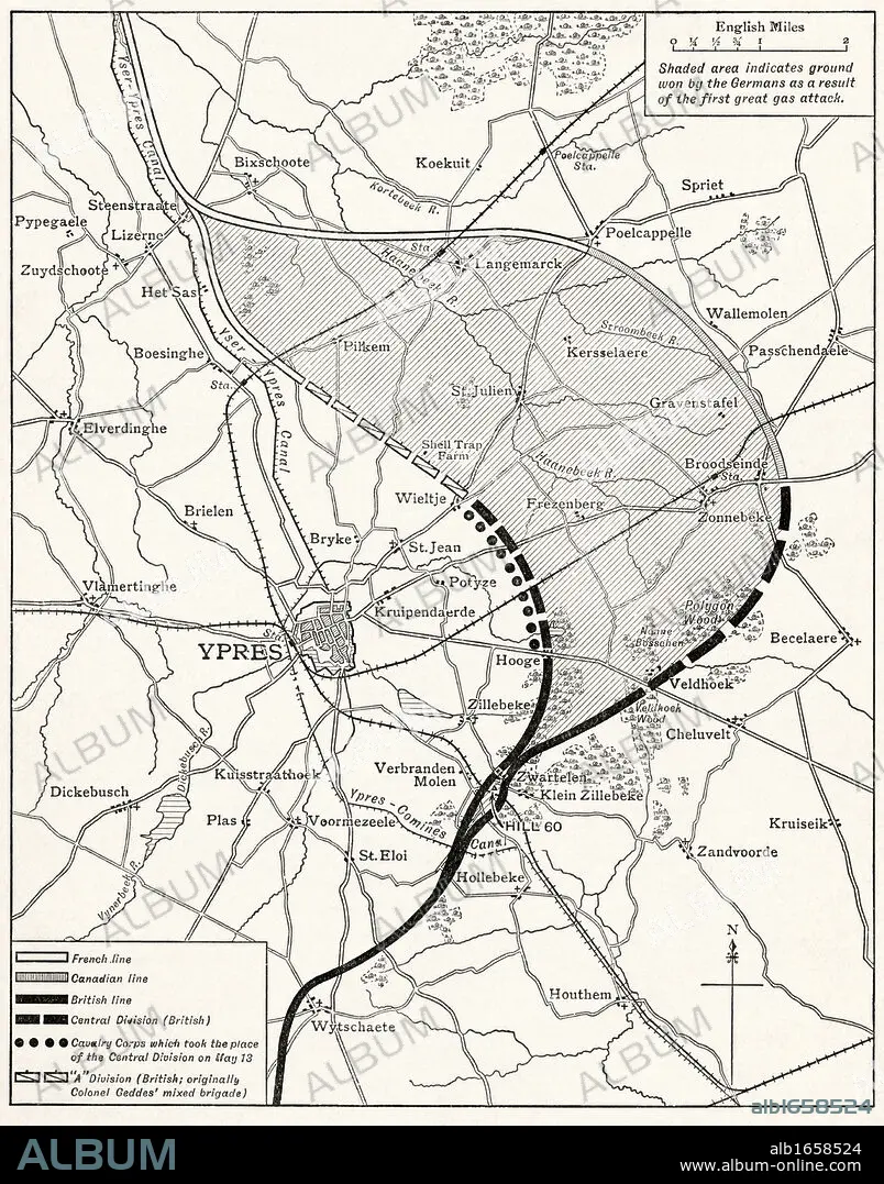
Map showing the Ypres Salient before and after the Second Battle of Ypres April and May 13 1915. From The Great World War A History Volume III, published 1916.
| Share |
|---|
 Pinterest Pinterest |
 Twitter Twitter |
 Facebook Facebook |
 Copy link Copy link |
 Email Email |
|
Add to another lightbox |
|
Add to another lightbox |


Buy this image.
Select the use:

Caption: Map showing the Ypres Salient before and after the Second Battle of Ypres April and May 13 1915. From The Great World War A History Volume III, published 1916.
Category: UIG HISTORY
Credit: Album / Universal History Archive/Universal Images Group
Releases: ? Model Release: No - ? Property Release: No
Rights questions?
Rights questions?
Image size: 3905 × 4972 px | 55.5 MB
Print size: 33.1 × 42.1 cm | 1537.4 × 1957.5 in (300 dpi)
Keywords: BATTLE • BELGIAN • BELGIUM • COMBAT • DISPUTE • FIELDS • FIGHT • FIGHTING • FIRST • FLANDERS • FLEMISH • GREAT • GUERRA • HUNDRED YEARS WAR • ILLUSTRATION • ILLUSTRATIONS • ILUSTRATION • KEN • MAP YPRES • ONE • SALIENT • SCUFFLE • SECOND • STRUGGLE • UIG HISTORY • WAR • WARFARE • WARS • WELSH • WORLD
