alb2655609
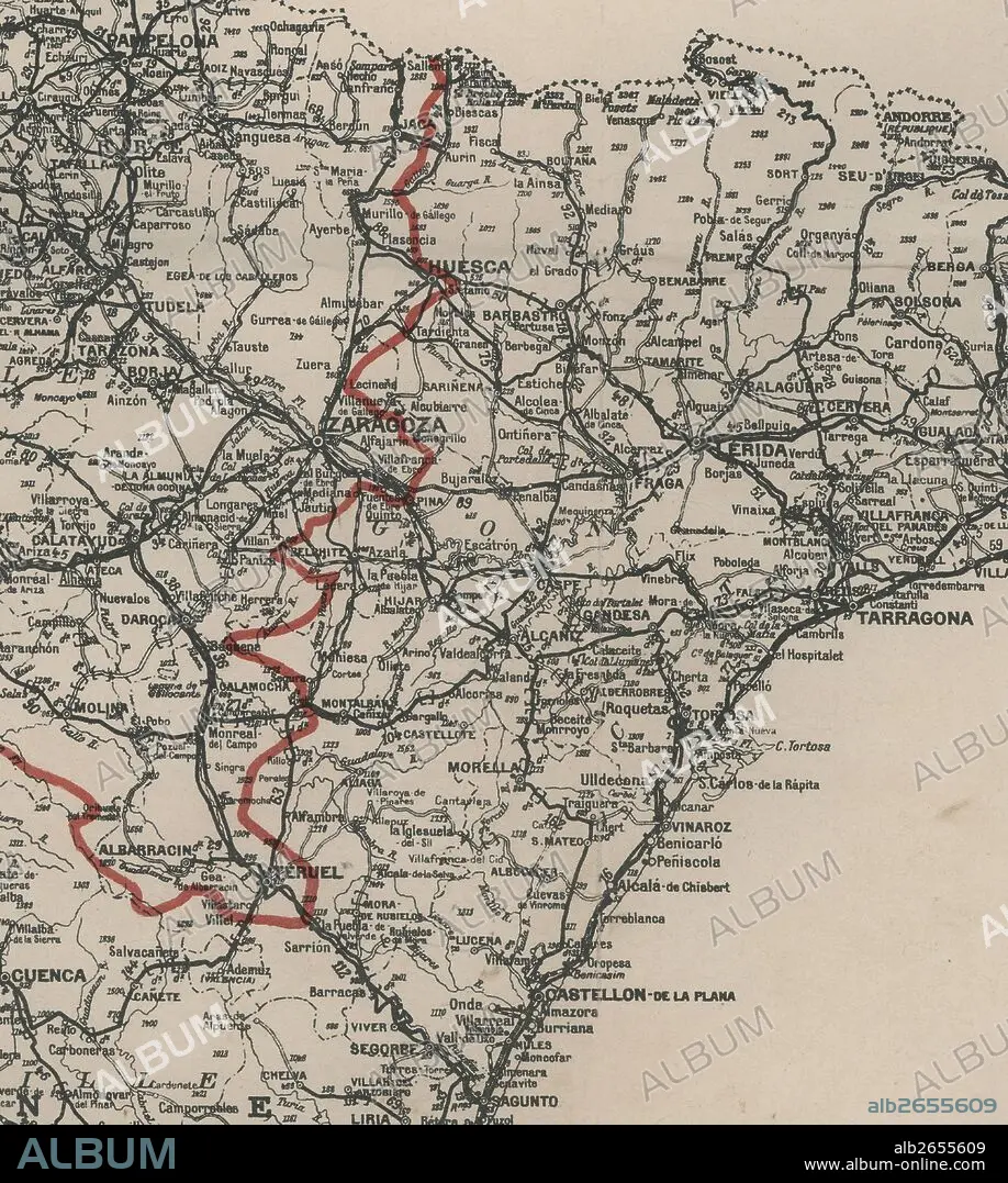
Carte d'Espagne - 1937. Mapa de España. Detalle del frente de guerra en la zona de Aragón.
| Share |
|---|
 Pinterest Pinterest |
 Twitter Twitter |
 Facebook Facebook |
 Copy link Copy link |
 Email Email |
|
Add to another lightbox |
|
Add to another lightbox |


Buy this image.
Select the use:

Caption:
Automatic translation: Carte d'Espagne - 1937. Map of Spain. Detail of the war front in the Aragon area
Carte d'Espagne - 1937. Mapa de España. Detalle del frente de guerra en la zona de Aragón.
Credit:
Album / Documenta
Releases:
Model: No - Property: No
Rights questions?
Rights questions?
Image size:
4100 x 4574 px | 53.7 MB
Print size:
34.7 x 38.7 cm | 13.7 x 15.2 in (300 dpi)
Keywords:
20TH CENTURY • BORDER • CIVIL WAR • COSTUME SKETCH • ESPANA • MAP • MAPS • PLAN (CARTOGRAPHY) • SKETCH • SPAIN
