alb4087167
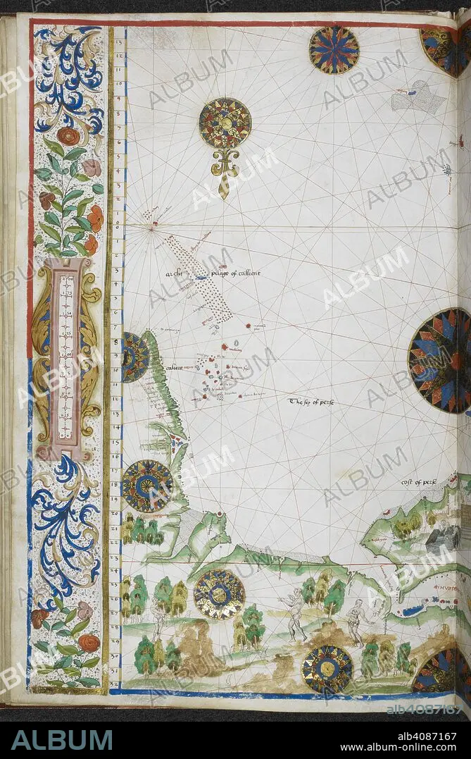
Chart of the coasts of Asia and Africa from Cape Comorin to Cape Delgado, including the Persian Gulf and the Red Sea. Jean Rotz, Boke of Idrography (The 'Rotz Atlas'). c 1535-1542. Source: Royal MS 20 E IX f.11v. Language: French & English.
| Share |
|---|
 Pinterest Pinterest |
 Twitter Twitter |
 Facebook Facebook |
 Copy link Copy link |
 Email Email |
|
Add to another lightbox |
|
Add to another lightbox |


Buy this image.
Select the use:

Author: JEAN ROTZ
Caption: Chart of the coasts of Asia and Africa from Cape Comorin to Cape Delgado, including the Persian Gulf and the Red Sea. Jean Rotz, Boke of Idrography (The 'Rotz Atlas'). c 1535-1542. Source: Royal MS 20 E IX f.11v. Language: French & English.
Credit: Album / British Library
Releases: ? Model Release: No - ? Property Release: No
Rights questions?
Rights questions?
Image size: 4363 × 6682 px | 83.4 MB
Print size: 36.9 × 56.6 cm | 1717.7 × 2630.7 in (300 dpi)
Keywords: 16 16TH XVI XVITH SIXTEENTH CENTURY • 16 CENTURY • 16TH CENTURY • 16TH • AFRICA • AFRICAN • ARCHIVE • ARCHIVES • CARTE • CARTOGRAPHIC • CARTOGRAPHY • COAST • COASTAL • COASTLINE • COLOR • COLORS • COLOUR • COLOURS • DOCUMENT • FLUSH • MANUSCRIPT • MAP MAKING • MAP • MAPS • MARITIME • PLAN (CARTOGRAPHY) • RED SEA • ROTZ, JEAN • SEACOAST • SEAFRONT • SEASCAPE WITH BEACH • SEASHORE • SEASIDE • SHORELINE • XVI CENTURY
