alb1650398
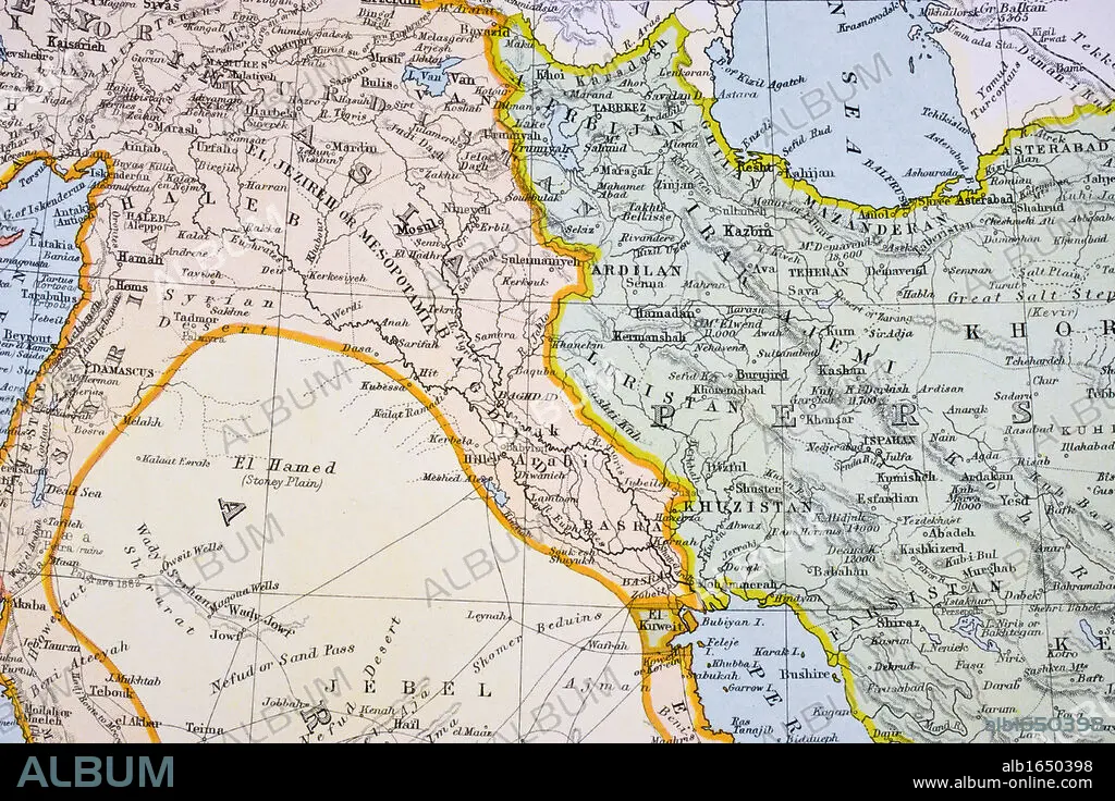
Partial map of Turkey Kurdistan Iraq Persia Middle East in 1890s From The Citizen's Atlas of the World published London circa 1899.
| Share |
|---|
 Pinterest Pinterest |
 Twitter Twitter |
 Facebook Facebook |
 Copy link Copy link |
 Email Email |
|
Add to another lightbox |
|
Add to another lightbox |


Buy this image.
Select the use:

Caption:
Partial map of Turkey Kurdistan Iraq Persia Middle East in 1890s From The Citizen's Atlas of the World published London circa 1899
Category:
UIG HISTORY
Credit:
Album / Universal History Archive/Universal Images Group
Releases:
Image size:
5457 x 3638 px | 56.8 MB
Print size:
46.2 x 30.8 cm | 18.2 x 12.1 in (300 dpi)
Keywords:
19 CENTURY • 19TH CENTURY • 19TH CENTURY. • 19TH • 19TH-CENTURY • ANT. OR.: IRAN • ATLAS • CENTURY • COLOR • COLOUR • EAST • FLUSH • HORIZONTAL • IRAK • IRAN • IRAQ • KEN • KURDISTAN • MAP • MAPS • MIDDLE • MYTH: PERSIAN • NINETEENTH CENTURY • NINETEENTH • ORIENT • PARTIAL • PERSIA • PERSIAN ART • PERSIAN MYTH • PERSIAN • PLAN (CARTOGRAPHY) • TURKEY • UIG HISTORY • WELSH • XIX CENTURY
