alb1647120
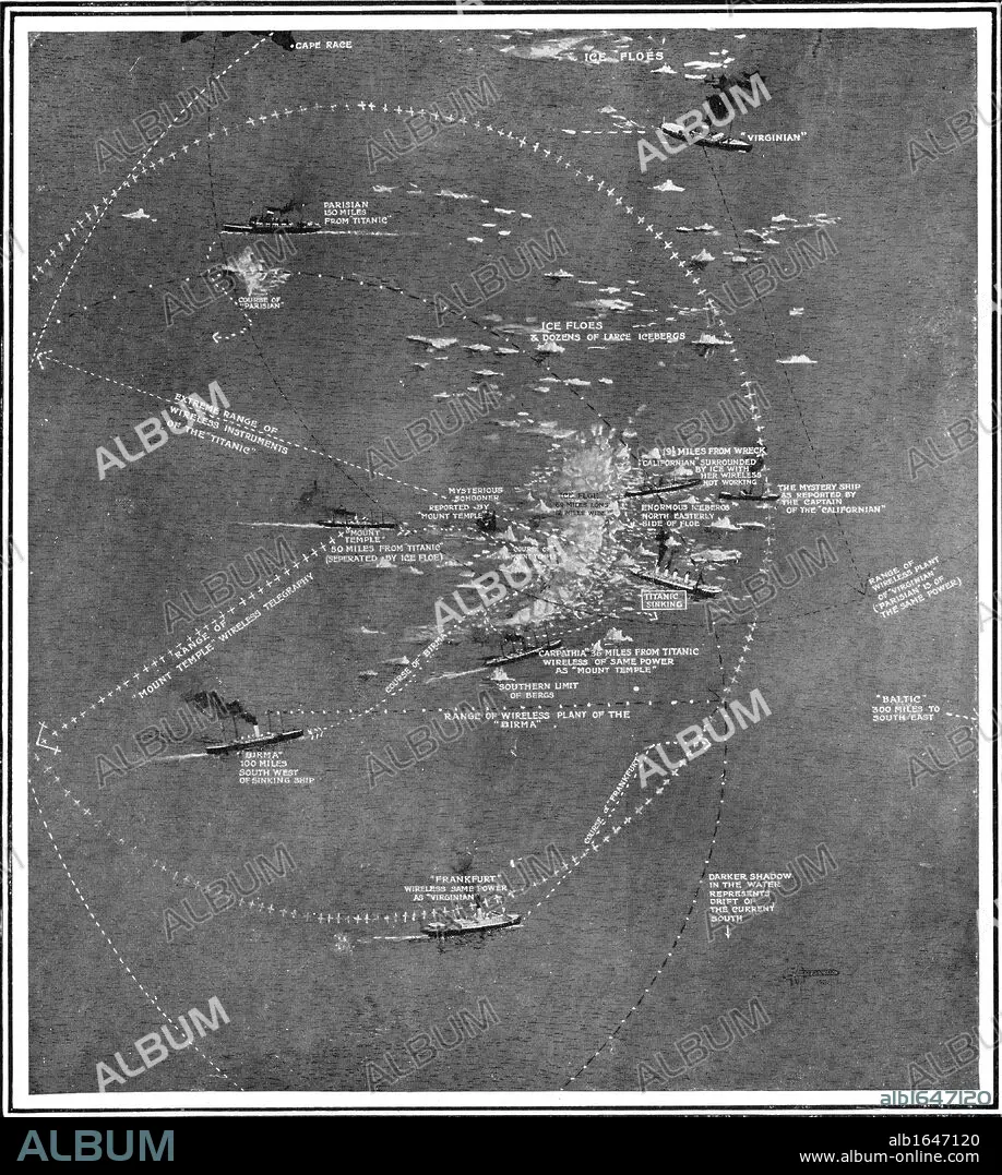
Chart of the RMS Titanic wreck site showing ships within call by wireless at the time of the collision.
| Share |
|---|
 Pinterest Pinterest |
 Twitter Twitter |
 Facebook Facebook |
 Copy link Copy link |
 Email Email |
|
Add to another lightbox |
|
Add to another lightbox |


Caption:
Chart of the RMS Titanic wreck site showing ships within call by wireless at the time of the collision
Credit:
Album / Universal Images Group / Universal History Archive
Releases:
Model: No - Property: No
Rights questions?
Rights questions?
Image size:
4129 x 4606 px | 54.4 MB
Print size:
35.0 x 39.0 cm | 13.8 x 15.4 in (300 dpi)
Keywords:
ACCIDENT • AREA • AT • B & W • B / W • B&W • BLACK & WHITE • BLACK AND WHITE • BRITISH • CALAMITY • CALL • CATASTROPHE • CHART • COLLISION • CRASH • DIED • DISASTER • DISASTERS • DISTRESS AT SEA • ENGLISH • FLEET • ICEBERG • INGLES • KEN • LINE • MAP • MAPS • MARINE • MISFORTUNE • NAVY • OCEAN • PENTHOUSE • PHOTO • PHOTOGRAPH • PHOTOGRAPHY • PLAN (CARTOGRAPHY) • RADIO • RADIUS • RMS • ROOF FLAT • SANK • SEA • SEAS • SHIP • SHIP: SHIPWRECK • SHIPWRECK • SMASH-UP • SQUARE • STAR • TITANIC • TOP-FLOOR APARTMENT • WELSH • WHITE • WIRELESS
