alb9388817
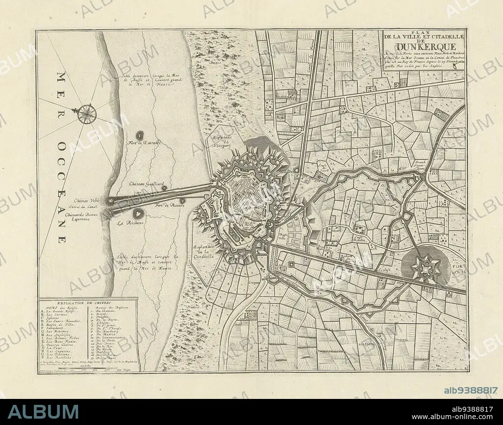
Map of Dunkirk, 1711, Plan de la ville et citadelle de Dunkerque (title on object), Map of Dunkirk, 1711. Legend A-P and 1-17 at bottom left. Part of a bundled collection of plans of battles and cities famous in the War of the Spanish Succession., print maker: J.G. Harrewijn (II) (mentioned on object), publisher: Eugene Henry Fricx (mentioned on object), Brussels, 1711, paper, etching, height 382 mm × width 480 mm.
| Share |
|---|
 Pinterest Pinterest |
 Twitter Twitter |
 Facebook Facebook |
 Copy link Copy link |
 Email Email |
|
Add to another lightbox |
|
Add to another lightbox |


Caption:
Map of Dunkirk, 1711, Plan de la ville et citadelle de Dunkerque (title on object), Map of Dunkirk, 1711. Legend A-P and 1-17 at bottom left. Part of a bundled collection of plans of battles and cities famous in the War of the Spanish Succession., print maker: J.G. Harrewijn (II) (mentioned on object), publisher: Eugene Henry Fricx (mentioned on object), Brussels, 1711, paper, etching, height 382 mm × width 480 mm
Credit:
Album / quintlox
Releases:
Model: No - Property: No
Rights questions?
Rights questions?
Image size:
5100 x 4038 px | 58.9 MB
Print size:
43.2 x 34.2 cm | 17.0 x 13.5 in (300 dpi)
Keywords:
1-17 • 1711 • BATTLES • BOTTOM LEFT • BRUSSELS • BUNDLED COLLECTION • CITIES FAMOUS • CITY OF BRUSSELS • DUNKIRK • ETCHING • EUGENE HENRY FRICX • HARREWIJN • HEIGHT 382 MM • HUNDRED YEARS WAR • II • J. G • LEGEND A-P • MAP • MAPS • MENTIONED • PAPER AND PACKAGE PRODUCTS • PAPER • PART • PLAN (CARTOGRAPHY) • PLAN DE LA VILLE ET CITADELLE DE DUNKERQUE • PLANS • PRINT MAKER • PUBLISHER • SPANISH SUCCESSION • WAR • WARFARE • WARS • WIDTH 480 MM
