alb4079231
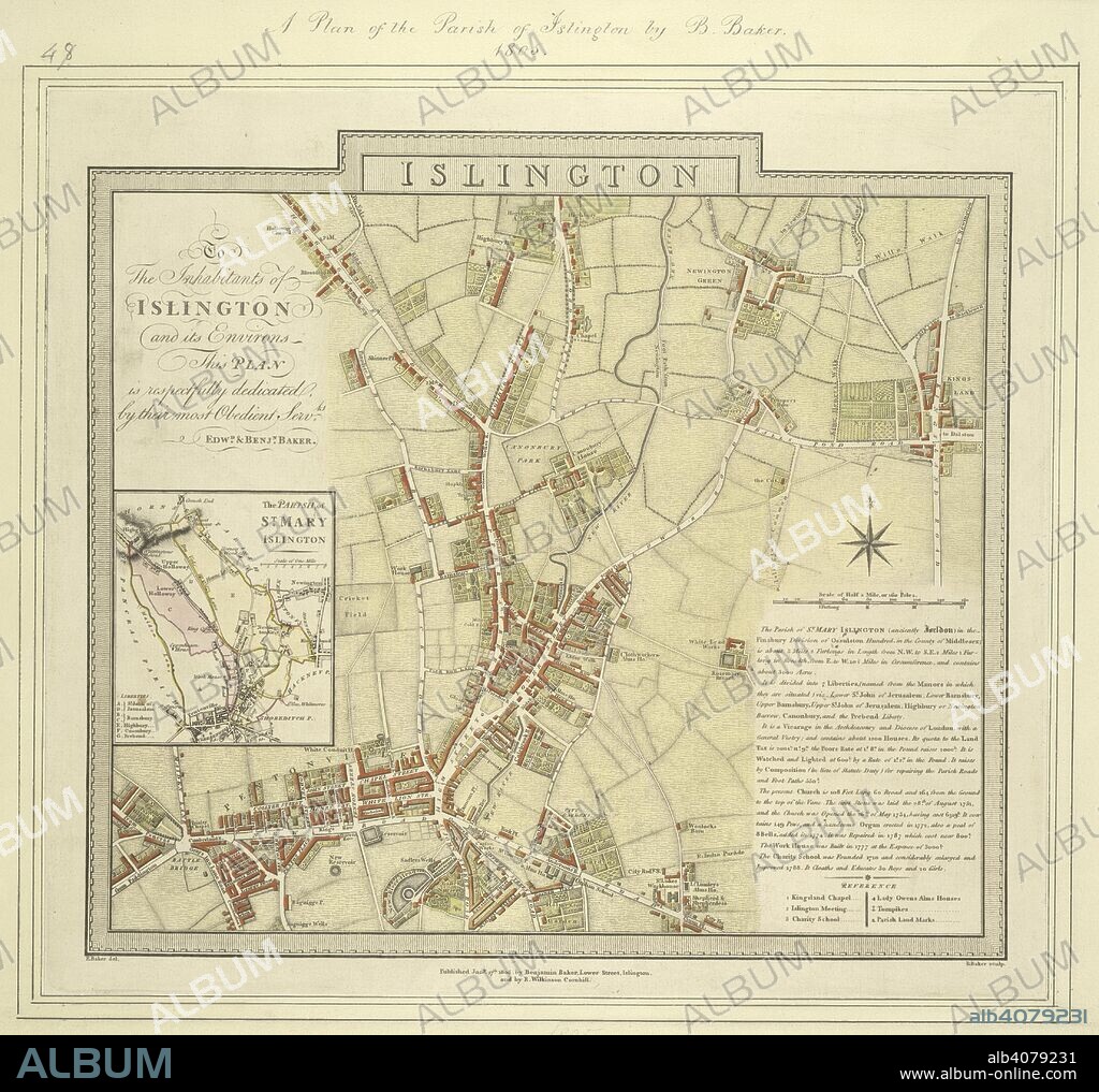
BENJAMIN BAKER. Map of the borough of Islington with inset plan of the parish of St Mary's on the left of the plate and note giving information about the borough down the right side of the plate. The plan shows the New River, a man made water course supplying London with fresh water from Hertfordshire. . Map of the borough of Islington. 1805. Source: Maps Crace Port 15.48.

|
Add to another lightbox |
|
Add to another lightbox |


Buy this image.
Select the use:

Author:
Caption:
Map of the borough of Islington with inset plan of the parish of St Mary's on the left of the plate and note giving information about the borough down the right side of the plate. The plan shows the New River, a man made water course supplying London with fresh water from Hertfordshire. . Map of the borough of Islington. 1805. Source: Maps Crace Port 15.48.
Credit:
Album / British Library
Releases:
Image size:
4428 x 4167 px | 52.8 MB
Print size:
37.5 x 35.3 cm | 14.8 x 13.9 in (300 dpi)
Keywords:
19 CENTURY • 19TH CENTURY • 19TH CENTURY. • 19TH • 19TH-CENTURY • ALBION • BAKER, BENJAMIN • BRITAIN • BRITISH ISLES • CARTE • CARTOGRAPHIC • CARTOGRAPHY • CITY OF LONDON • COLOR • COLORS • COLOUR • COLOURS • ENGLAND'S • ENGLAND • EUROPA • EUROPE • FLUSH • GREAT BRITAIN • GREAT-BRITAIN • ISLINGTON • LONDON CITY • LONDON • LONDON. • MAP MAKING • MAP • MAPS • NINETEENTH CENTURY • PLAN (CARTOGRAPHY) • U. K. • UNITED KINGDOM • WESTERN EUROPE • XIX CENTURY


 Pinterest
 Twitter
 Facebook
 Copy link
 Email
Email
