alb3907894
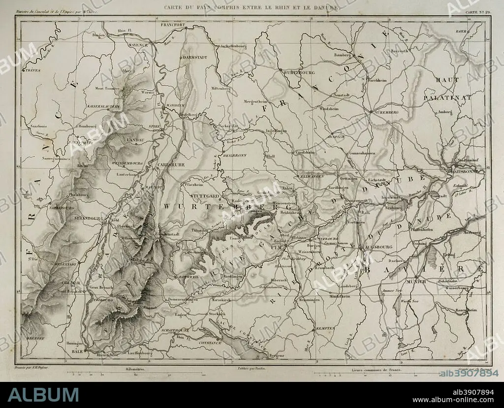
Map of the territory between the river Rhine and the Danube. Atlas de l'Histoire du Consulat et de l'Empire. History of the Consulate and the Empire of France under Napoleon by Marie Joseph Louis Adolphe Thiers (1797-1877). Drawings by Dufour, engravings by Dyonnet. Edited in Paris, 1864.
| Share |
|---|
 Pinterest Pinterest |
 Twitter Twitter |
 Facebook Facebook |
 Copy link Copy link |
 Email Email |
|
Add to another lightbox |
|
Add to another lightbox |


Buy this image.
Select the use:

Caption: Map of the territory between the river Rhine and the Danube. Atlas de l'Histoire du Consulat et de l'Empire. History of the Consulate and the Empire of France under Napoleon by Marie Joseph Louis Adolphe Thiers (1797-1877). Drawings by Dufour, engravings by Dyonnet. Edited in Paris, 1864.
Personalities: NAPOLÉON (1769-1821)
Credit: Album / Prisma
Releases: ? Model Release: No - ? Property Release: No
Rights questions?
Rights questions?
Image size: 4961 × 3760 px | 53.4 MB
Print size: 42.0 × 31.8 cm | 1953.1 × 1480.3 in (300 dpi)
Keywords: 1864 • 19 CENTURY • 19TH CENTURY • 19TH CENTURY. • 19TH • 19TH-CENTURY • ADOLPHE THIERS • ANCIENT • ANTIQUE • ATLANTE • ATLANTEAN • ATLAS DE L'HISTOIRE DU CONSULAT ET DE L'EMPIRE • ATLAS DE L'HISTORIE DU CONSULAT ET DE L'EMPIRE • ATLAS • AUTHOR • BAVARIA (PERSONIFICATION) • BAVARIA • BAYERN • BOOK • BOOKS • CARTOGRAPHY • CENTRAL EUROPE • DANUBE RIVER • DANUBE • DESIGNING • DEUTSCHLAND • DRAWING • DRAWN • DUFOUR • DYONNET • EDITION • EMPIRE • ENGRAVED • ENGRAVER • ENGRAVING (ARTWORK) • ENGRAVING • ENGRAVING. • ENGRAVINGS • ETCHING • EUROPA CENTER • EUROPA • EUROPE • EUROPEA • EUROPEAN • EUROPEANS • FIRST FRENCH EMPIRE • FLUVIAL • FRANCE • FRANCE. • FRANCONIA • FRANÇAIS • FRENCH EMPIRE • FRENCH • GEOGRAFIA • GEOGRAPHICAL • GEOGRAPHY • GERMANY • HISTORIA UNIVERSAL • HISTORIA • HISTORIC • HISTORICAL • HISTORY OF THE CONSULATE AND THE EMPIRE OF FRANCE UNDER NAPOLEON • HISTORY OF THE CONSULATE AND THE NAPOLEON EMPIRE • HISTORY • HISTORY. • ILLUSTRATION • ILLUSTRATIONS • ILUSTRATION • LA FRANCE • LANDAU • LIBRO • LIBROS • MAP MAKING • MAP • MAPS • MARIE JOSEPH LOUIS ADOLPHE THIERS • MODERN AGE • MODERN ERA • MODERN PERIOD • MUNICH • NAPOLEON I BONAPARTE • NAPOLEON I • NAPOLEON'S FRENCH EMPIRE • NAPOLEON • NAPOLEONIC EMPIRE • NAPOLEONIC MAP • NAPOLEONIC PERIOD • NINETEENTH CENTURY • NUREMBERG • OLD • PARIS • PLAN (CARTOGRAPHY) • PLAN • PLANE • PRINT • PUBLICATION • RHEIN • RHIN • RHINE • RIN • RIVER DANUBE • RIVER • STREAM • STUTTGART • SURFACE • TERRITORY • THIERS • TWO-HORSE CARRIAGE • WORK • WORKING • WURTEMBERG • XIX CENTURY
