alb8368724
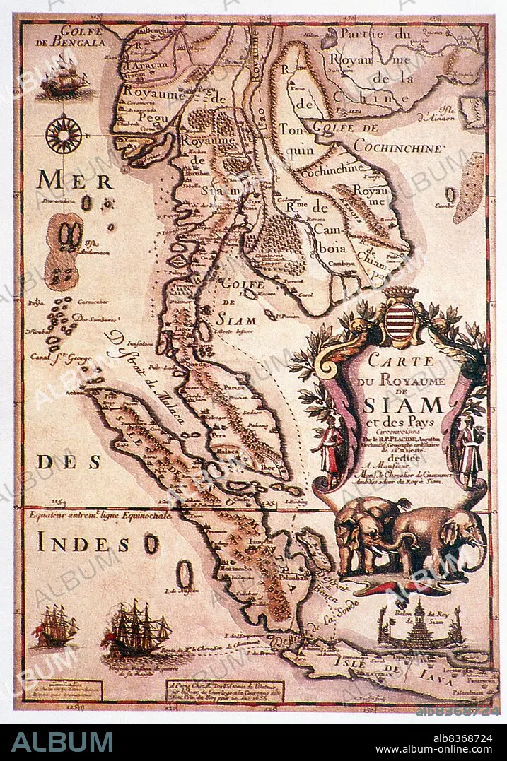
Thailand: 'Carte du Royaume de Siam', a 17th century map of Siam and other parts of Southeast Asia by Placide de Sainte-Helene (1686)
| Share |
|---|
 Pinterest Pinterest |
 Twitter Twitter |
 Facebook Facebook |
 Copy link Copy link |
 Email Email |
|
Add to another lightbox |
|
Add to another lightbox |


Buy this image.
Select the use:

Title:
Thailand: 'Carte du Royaume de Siam', a 17th century map of Siam and other parts of Southeast Asia by Placide de Sainte-Helene (1686)
Caption:
Placide de Sainte-Helene (Augustinus Placidus, 1648 - 1734) cartographer and Augustine monk was the brother-in-law of Pierre Duval (1618 - 1683), geographer to the King of France, Louis XIV.
Credit:
Album / Universal Images Group / Pictures From History
Releases:
Image size:
3386 x 4839 px | 46.9 MB
Print size:
28.7 x 41.0 cm | 11.3 x 16.1 in (300 dpi)
Keywords:
1686 • 17TH CENTURY • 17TH CENTURY. • 17TH • 17TH-CENTURY • ACEH • ACHIN • ASIA • ASIAN • AVA • BURMA • CAMBODIA • CARTOGRAPHY • CHAMPA • CIAMPA • COCHINCHINA • COLONIALISM • IMPERIALISM • JAVA • LAN NA • LANCHANG • LANNA • LAO • LAOS • MAP MAKING • MAP • MAPS • MYANMAR • PEGU • PLAN (CARTOGRAPHY) • SIAM • SIAMESE • SOUTHEAST ASIA • SUMATRA • THAILAND • TONKIN • TONQUIN • VIETNAM • XVII CENTURY
