alb9839453
ANON. Map of Noord-Holland and part of Friesland, 1726-1750. Creator: Anon.
| Share |
|---|
 Pinterest Pinterest |
 Twitter Twitter |
 Facebook Facebook |
 Copy link Copy link |
 Email Email |
|
Add to another lightbox |
|
Add to another lightbox |


Author:
Title:
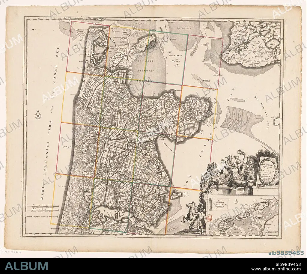
Map of Noord-Holland and part of Friesland, 1726-1750. Creator: Anon.
Caption:
Map of Noord-Holland and part of Friesland, 1726-1750. At the bottom right the title cartouche with figures around it including a man with a horse, satyrs, putti, Mercury who takes the horn of plenty from a female figure, and a river god. Below that a deployment map of the Wadden area with scale.
Credit:
Album / Heritage Art/Heritage Images
Releases:
Model: No - Property: No
Rights questions?
Rights questions?
Image size:
5914 x 4972 px | 84.1 MB
Print size:
50.1 x 42.1 cm | 19.7 x 16.6 in (300 dpi)
Keywords:
18TH CENTURY • 18TH CENTURY, THE • 18TH • AMORINI • ANGELIC • ANIMAL • ANIMALS • ANON • ANONYMOUS • ART CENTRE • ART GALLERY • ART • ARTEFACT • ARTIFACT • ARTS • BLACK & WHITE • BLACK AND WHITE • CARTOGRAPHY • CARTOUCHE • CENTURY • CHERUB • CHERUBIM • CHERUBIMS • CHERUBS • COLOR • COLOUR • CONCEPT • CORNUCOPIA • CULTURE • DEITY • DEPICTION • DEPLOYMENT • DRAWING • DUTCH • EIGHTEENTH CENTURY • ENGRAVED • ENGRAVING • ETCHED • ETCHING • EUROPE • EXHIBIT • EXHIBITION • FEMALE • FIGURE • FIGURES • FRIESLAND • GALLERY • GOD • GUY • HISTORIC • HISTORICAL • HISTORY • HORN OF PLENTY • HORSE • HORSES • ILLUSTRATED • ILLUSTRATION • ILLUSTRATIONS • LETTERING • LOW COUNTRIES • MALE • MAN • MAP MAKING • MAP • MAP-MAKING • MAPMAKING • MEASUREMENT • MEASUREMENTS • MEN • MERCURY • MUSEUM • MYTHICAL BEAST • MYTHICAL BEASTS • MYTHICAL CREATURE • MYTHICAL CREATURES • MYTHICAL FIGURE • MYTHOLOGICAL CREATURE • MYTHOLOGICAL FIGURE • MYTHOLOGICAL • MYTHOLOGY • NETHERLANDISH • NETHERLANDS • NOORD-HOLLAND • NORTH HOLLAND • PAPER • PEN, PENCIL • PENCIL • PEOPLE • PRINT • PUTTI • PUTTO • QUERUBIN • RELIGION • RELIGIOUS • RIJKSMUSEUM • SATYR • SATYRS • SCALE DRAWING • SCALE • SCENE • TEXT • TITLE • WATERCOLOUR (PAINT) • WATERCOLOUR ON PAPER • WATERCOLOUR • WHITE AND BLACK • WOMAN • WOMEN
