alb3548831
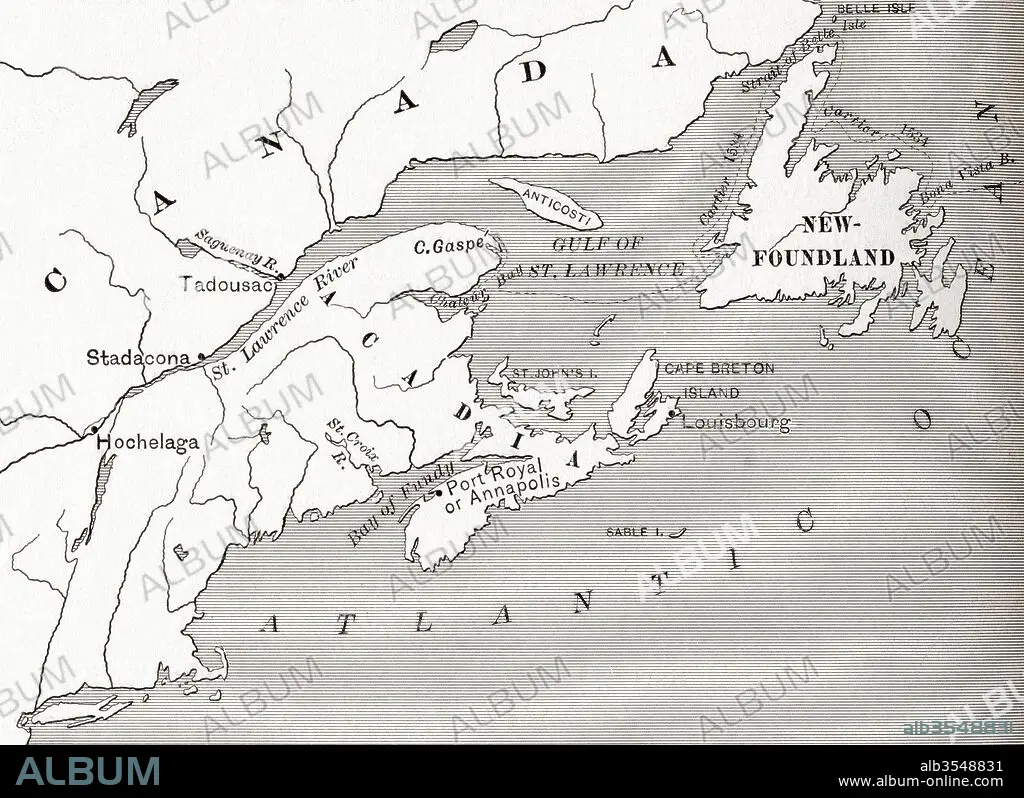
Map of Acadia, 17th century colony of New France in northeastern North America, and the water highway to Canada
| Share |
|---|
 Pinterest Pinterest |
 Twitter Twitter |
 Facebook Facebook |
 Copy link Copy link |
 Email Email |
|
Add to another lightbox |
|
Add to another lightbox |


Buy this image.
Select the use:

Title:
Map of Acadia, 17th century colony of New France in northeastern North America, and the water highway to Canada
Caption:
Map of Acadia, 17th century colony of New France in northeastern North America, and the water highway to Canada. From The History of Our Country, published 1899
Credit:
Album / Universal Images Group / Universal History Archive
Releases:
Image size:
5075 x 3690 px | 53.6 MB
Print size:
43.0 x 31.2 cm | 16.9 x 12.3 in (300 dpi)
Keywords:
17TH CENTURY • 17TH CENTURY. • 17TH • ACADIA • AMERICA • AMERICA. • AMERICAN • AMERICANS • AMERICAS • AMERICAS, THE • CANADA • CANADA. • CENTURY • CHART • COLONY • COUNTRIES • COUNTRY • EEUU • EXPRESSWAY • FRENCH • GEOGRAFIA • GEOGRAPHICAL • GEOGRAPHY • HIGHWAY • MAP • MAPS • MOTORWAY • NEW FRANCE • NORDEN • NORTH • NORTHEASTERN • PLAN (CARTOGRAPHY) • SEVENTEENTH • STATES • U S A • U. S. A • U. S. A. • U. S. • UNITED STATES AMERICA • UNITED STATES OF AMERICA • UNITED STATES • UNITED • US • USA • USA. UNITED STATES • WATER • WATER-HIGHWAY • XVII CENTURY
