alb3840505
Kangerdlugssuaq Glacier, Greenland
| Share |
|---|
 Pinterest Pinterest |
 Twitter Twitter |
 Facebook Facebook |
 Copy link Copy link |
 Email Email |
|
Add to another lightbox |
|
Add to another lightbox |


Buy this image.
Select the use:

Title:
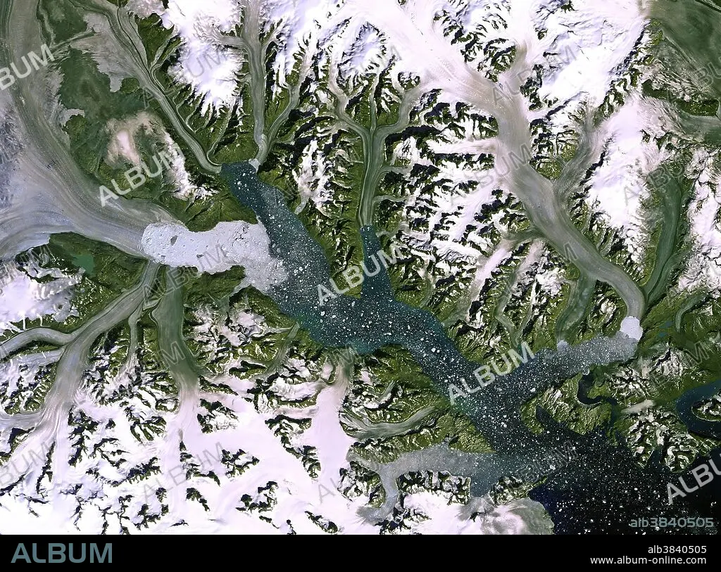
Kangerdlugssuaq Glacier, Greenland
Caption:
The Kangerdlugssuaq glacier and its ice stream, in an image from the Landsat-7 satellite. It is the largest outlet glacier on Greenland's east coast, discharging ice into the surrounding oceans. A recent study based on satellite observations revealed that over the past 20 years the ice melting in Greenland and Antarctica has contributed about 11 mm to the global sea-level rise. This image clearly shows the glacier's calving front, where ice breaks away. Over the years, satellite images have shown that this front has retreated, which indicates that the glacier is getting smaller over time.
Category:
Ecology & Environment • Astronomy & Space
Credit:
Album / Science Source / USGS/ESA
Releases:
Image size:
3212 x 2384 px | 21.9 MB
Print size:
27.2 x 20.2 cm | 10.7 x 7.9 in (300 dpi)
Keywords:
AERIAL • ASTRONOMY & SPACE • CALVING • CLIMATE CHANGE • EARTH FROM ABOVE • EARTH OBSERVATION • ECOLOGY & ENVIRONMENT • ENVIRONMENT • FJORD • FLEET • FRESH WATER • FRESHWATER • GEOGRAFIA • GEOGRAPHY • GLACE • GLACIAR • GLACIATION • GLACIER • GLOBAL WARMING • GREENLAND • GREENLAND: GRL • ICE (WEATHER) • ICE SHEET • ICE STREAM • ICE • ICE, FROZEN LAKES&STREAMS • ICEBERG • ICEPACK • KANGERDLUGSSUAQ GLACIER • LANDSAT • LANDSAT-7 • LANDSCAPE • LANDSCAPES • MARINE • MELT • MELTING • NAVY • OCEAN • OCEANS • OUTLET GLACIER • RETREATING GLACIER • SALINITY • SATELLITE IMAGE • SATELLITE IMAGERY • SCENIC • SEA LEVEL RISE • SEA • SEA-LEVEL • SEA. • SEAS
