alb5092835
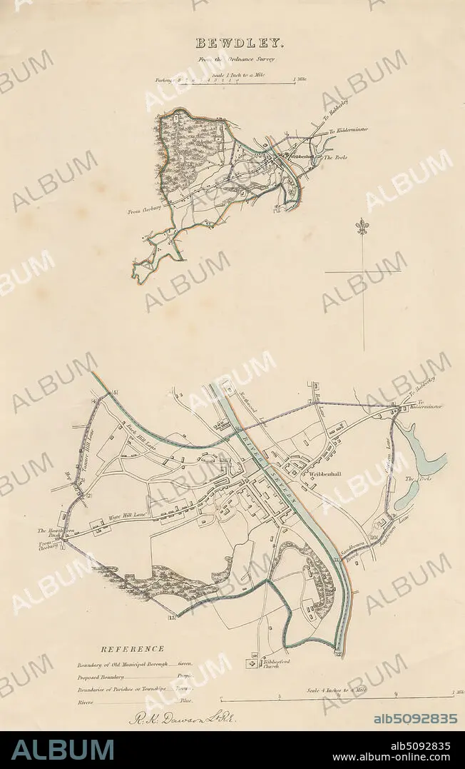
Map of Bewdley from the Ordnance Survey, Print made by Robert Kearsley Dawson, 17981861, British, undated, Etching with hand coloring on moderately thick, slightly textured, cream wove paper, Sheet: 13 9/16 x 8 7/16 inches (34.4 x 21.4 cm) and Image: 10 3/4 x 7 inches (27.3 x 17.8 cm), architectural subject, boundaries, cartographic material, cartography, key (text), map, river, scale (rule), still life, streets, town, Bewdley, England, Hereford and Worcester, Severn, United Kingdom.
| Share |
|---|
 Pinterest Pinterest |
 Twitter Twitter |
 Facebook Facebook |
 Copy link Copy link |
 Email Email |
|
Add to another lightbox |
|
Add to another lightbox |


Buy this image.
Select the use:

Caption:
Map of Bewdley from the Ordnance Survey, Print made by Robert Kearsley Dawson, 17981861, British, undated, Etching with hand coloring on moderately thick, slightly textured, cream wove paper, Sheet: 13 9/16 x 8 7/16 inches (34.4 x 21.4 cm) and Image: 10 3/4 x 7 inches (27.3 x 17.8 cm), architectural subject, boundaries, cartographic material, cartography, key (text), map, river, scale (rule), still life, streets, town, Bewdley, England, Hereford and Worcester, Severn, United Kingdom
Credit:
Album / quintlox
Releases:
Image size:
3177 x 4992 px | 45.4 MB
Print size:
26.9 x 42.3 cm | 10.6 x 16.6 in (300 dpi)
Keywords:
17981861 • ARCHITECTURAL SUBJECT • BEWDLEY • BOUNDARIES • BRITAIN • BRITISH • CARTOGRAPHIC MATERIAL • CARTOGRAPHY • CITIES • CITY • CIUDAD • CREAM WOVE PAPER • ENGLAND'S • ENGLAND • ENGLISH • ETCHING • FLUVIAL • GREAT BRITAIN • GREAT-BRITAIN • HAND COLORING • HEREFORD • IMAGE • KEY • LIFE • MAP MAKING • MAP • MAPS • MODERATELY THICK • ORDNANCE SURVEY • PLAN (CARTOGRAPHY) • PRINT • RIVER • ROBERT KEARSLEY DAWSON • RULE • SCALE • SEVERN • SHEET • SLIGHTLY TEXTURED • STREAM • STREETS • TEXT • TOWN • TOWNS • U. K. • UNITED KINGDOM • WORCESTER
