alb3924201
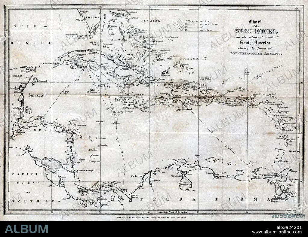
Chart of the West Indies, with the adjacent Coast of South America, 1830. Artist: J&C Walker
| Share |
|---|
 Pinterest Pinterest |
 Twitter Twitter |
 Facebook Facebook |
 Copy link Copy link |
 Email Email |
|
Add to another lightbox |
|
Add to another lightbox |


Buy this image.
Select the use:

Title:
Chart of the West Indies, with the adjacent Coast of South America, 1830. Artist: J&C Walker
Caption:
Chart of the West Indies, with the adjacent Coast of South America, 1830. Map of the Caribbean, showing the tracks of Christopher Columbus.
Credit:
Album / The Print Collector / Heritage Images
Releases:
Image size:
4940 x 3549 px | 50.2 MB
Print size:
41.8 x 30.0 cm | 16.5 x 11.8 in (300 dpi)
Keywords:
15 15TH XV XVTH FIFTEENTH CENTURY • 15TH CENTURY • 15TH CENTURY; • 15TH • 16 16TH XVI XVITH SIXTEENTH CENTURY • 16 CENTURY • 16TH CENTURY • 16TH • 19TH CENTURY • B & W • B / W • B W • B&W • BLACK & WHITE • BLACK AND WHITE • CARIBBEAN • CARTOGRAPHY • CENTURY • COAST • CONCEPT • CONTINENT • COUNTRY • DISCOVERER • DISCOVERY • ENGRAVING • EXPLORATION • EXPLORER • FIFTEENTH CENTURY • GENOESE • GEOGRAFIA • GEOGRAPHICAL FEATURE • GEOGRAPHY • INDIES • ISLAND • ITALIA • ITALIAN • ITALY • J&C WALKER • J&C • JOURNEY • JOURNEYMAN'S TRAVEL • JOURNEYMAN'S TRAVELS • LEISURE • LOCATION • MAP MAKING • MAP • MAP-MAKING • MONOCHROMATIC • MONOCHROME • NINETEENTH CENTURY • RESEARCHER (MALE) • RESEARCHER • ROUTE • SEA • SIGLO XV • SIXTEENTH CENTURY • SOUTH AMERICA • SPAIN • SPANISH • THRIP • TRAVEL • TRAVELING • TRAVELS • TRIP • TRIPS • VOYAGE • WALKER • WEST INDIES • XV CENTURY • XVI CENTURY
