alb3182088
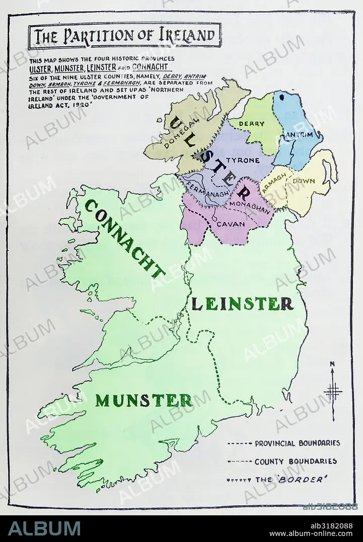
Map of the partition of Ireland
| Share |
|---|
 Pinterest Pinterest |
 Twitter Twitter |
 Facebook Facebook |
 Copy link Copy link |
 Email Email |
|
Add to another lightbox |
|
Add to another lightbox |


Title:
Map of the partition of Ireland
Caption:
Map of the partition of Ireland; the division of the island of Ireland into two distinct territories; Northern Ireland and Southern Ireland in 1921
Credit:
Album / Universal Images Group / Universal History Archive
Releases:
Model: No - Property: No
Rights questions?
Rights questions?
Image size:
3843 x 5457 px | 60.0 MB
Print size:
32.5 x 46.2 cm | 12.8 x 18.2 in (300 dpi)
Keywords:
DIVISION • EIRE • IRELAND • IRISH REPUBLIC • ISLA • ISLAND • ISLANDS • MAP • MAPS • NORTHERN IRELAND • PARTITION • PLAN (CARTOGRAPHY) • SIX COUNTIES • SOUTHERN IRELAND • ULSTER
