alb4205523
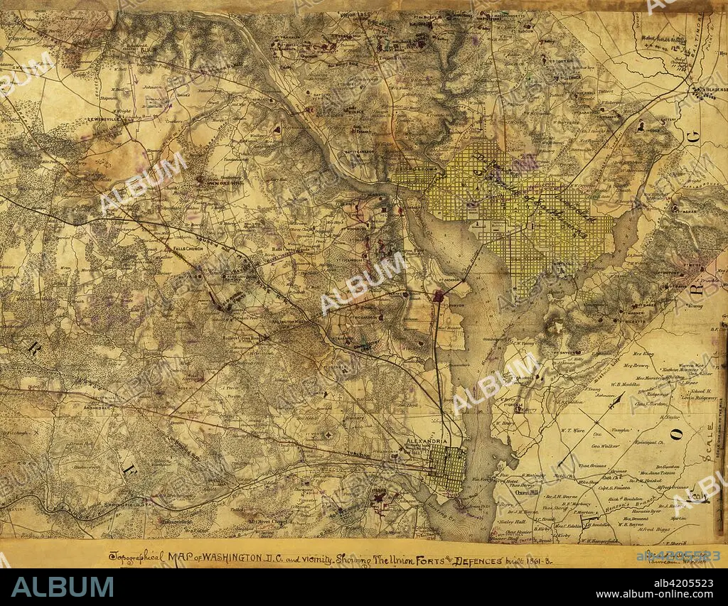
Washington, D. C., Showing the Union forts and defenses
| Share |
|---|
 Pinterest Pinterest |
 Twitter Twitter |
 Facebook Facebook |
 Copy link Copy link |
 Email Email |
|
Add to another lightbox |
|
Add to another lightbox |


Buy this image.
Select the use:

Title:
Washington, D. C., Showing the Union forts and defenses
Caption:
Topographical map of Washington, D.C., and vicinity. Showing the Union forts and defenses built 1861-3.. Topographical map of Washington, D.C., and vicinity. Showing the Union forts and defenses built 1861-3. Issued by Topographical Bureau, War Department, Col. Woodruff. - Col. Woodruff
Credit:
Album / Universal Images Group / Universal History Archive/UIG
Releases:
Model: No - Property: No
Rights questions?
Rights questions?
Image size:
5242 x 4094 px | 61.4 MB
Print size:
44.4 x 34.7 cm | 17.5 x 13.6 in (300 dpi)
Keywords:
AGGRESSION • BATTLE • BETWEEN • CARTOGRAPHY • CIVIL • COMBAT • CSA WASHINGTON • DC • DISPUTE • EE. UU. • ESTADOS UNIDOS USA EEUU EE. UU. EUA E. U. A. • FÉDÉRAL • FIGHT • FIGHTING • FORTIFICATIONS • FORTS • GUERRA • HUNDRED YEARS WAR • MAP MAKING • MAP • MAPS • NORTHERN • ORDER • PLAN (CARTOGRAPHY) • REBELLION • REBELS • SCUFFLE • STATES • STRUGGLE • U. S. A. • U.S. • UNITED STATES OF AMERICA • UNITED STATES • UNITED STATES, THE • UNITES STATES OF AMERICA USA • USA • WAR • WARFARE • WARS
