alb4094495
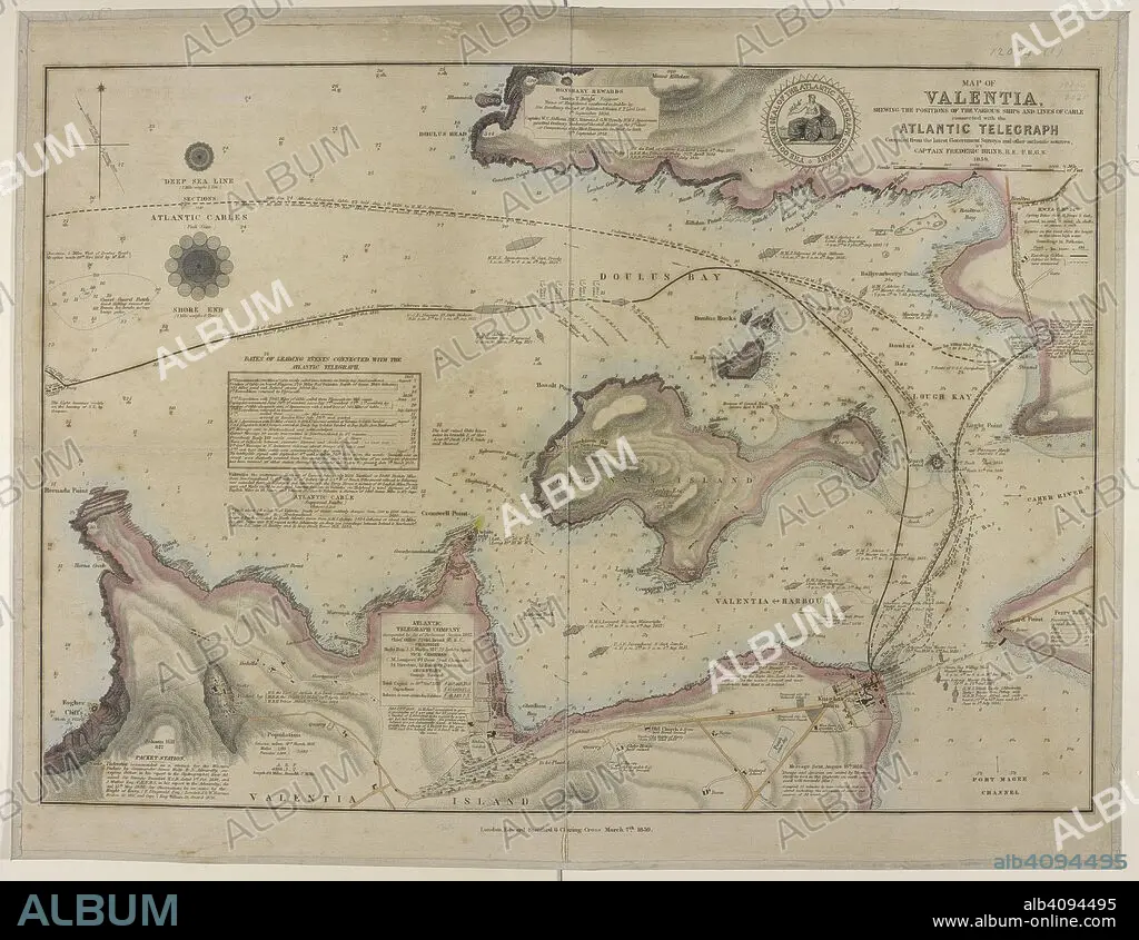
FREDERIC BRINE. Map showing a coast of Valentia island and the harbour; Doulus bay; and the lines of cables connected with the Atlantic telegraph. Map of Valentia shewing the positions of the various Ships and Lines of Cable connected with the Atlantic Telegraph. Compiled ... by Captain F. Brine. London : E. Stanford, 1859. Source: Maps.12094.(1).
| Share |
|---|
 Pinterest Pinterest |
 Twitter Twitter |
 Facebook Facebook |
 Copy link Copy link |
 Email Email |
|
Add to another lightbox |
|
Add to another lightbox |


Buy this image.
Select the use:

Author:
Caption:
Map showing a coast of Valentia island and the harbour; Doulus bay; and the lines of cables connected with the Atlantic telegraph. Map of Valentia shewing the positions of the various Ships and Lines of Cable connected with the Atlantic Telegraph. Compiled ... by Captain F. Brine. London : E. Stanford, 1859. Source: Maps.12094.(1).
Credit:
Album / British Library
Releases:
Model: No - Property: No
Rights questions?
Rights questions?
Image size:
5760 x 4456 px | 73.4 MB
Print size:
48.8 x 37.7 cm | 19.2 x 14.9 in (300 dpi)
Keywords:
19 CENTURY • 19TH CENTURY • 19TH • 19TH-CENTURY • ATLANTIC OCEAN • ATLANTIC • BRINE, FREDERIC • BRITISH ISLES • CARTE • CARTOGRAPHIC • CARTOGRAPHY • COLOR • COLORS • COLOUR • COLOURS • EIRE • ELECTRICAL TELEGRAPH • EUROPA • EUROPE • IRELAND • MAP MAKING • MAP • MAPS • NINETEENTH CENTURY • OCEAN, ATLANTIC • PLAN (CARTOGRAPHY) • REPUBLIC OF IRELAND • TELEGRAPH • TELEGRAPHS • TELEGRAPHY • WESTERN EUROPE • XIX CENTURY
