alb2128021
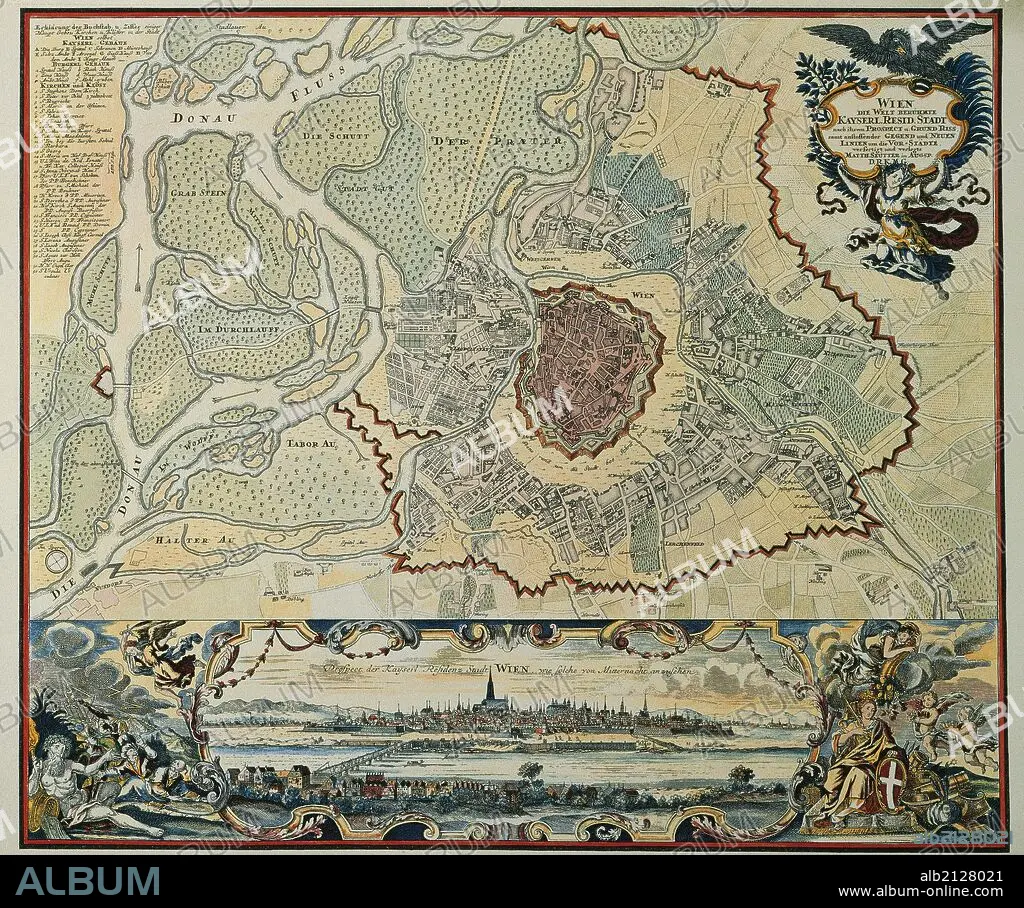
Austria. Vienna. Plan of the walled city with Prater and the Danube River. Engraving, 1720.
| Share |
|---|
 Pinterest Pinterest |
 Twitter Twitter |
 Facebook Facebook |
 Copy link Copy link |
 Email Email |
|
Add to another lightbox |
|
Add to another lightbox |


Buy this image.
Select the use:

Caption:
Austria. Vienna. Plan of the walled city with Prater and the Danube River. Engraving, 1720.
Credit:
Album / Prisma
Releases:
Model: No - Property: No
Rights questions?
Rights questions?
Image size:
5197 x 4338 px | 64.5 MB
Print size:
44.0 x 36.7 cm | 17.3 x 14.5 in (300 dpi)
Keywords:
1720 • 17TH CENTURY • 17TH • 18TH CENTURY • 18TH CENTURY, THE • 18TH • AERIAL • ANCIENT CARTOGRAPHY • AUSTRIA • AUSTRIAN • CANAL • CANALE • CANALS • CAPITAL • CARTOGRAPHY • CENTER • CENTRE • CHANNELS • CITY WALLS • CITY • DANUBE RIVER • DANUBE • ENGRAVED • ENGRAVING (ARTWORK) • ENGRAVING • ENGRAVING. • ENGRAVINGS • ETCHING • EUROPA • EUROPE • EUROPEA • EUROPEAN CITY • EUROPEAN • EUROPEANS • FLUVIAL • FORTIFIED WALL • FORTIFIED WALLS • HISTORIA UNIVERSAL • HISTORIA • HISTORY • MAP MAKING • MAP • MAPS • MODERN AGE • MODERN ERA • MODERN PERIOD • OVERVIEW • PALACE • PANORAMA • PANORAMIC VIEW • PLAN (CARTOGRAPHY) • PLAN • PLANE • PRATER • PRINT • RIVER DANUBE • RIVER • STANDPOINT • STREAM • URBANISM • URBE • VIEWPOINT • VILLAGE • WALL • WALLED CITY • WALLED • WATERWAY • WIEN • XVII CENTURY • XVIII CENTURY
