alb4460817
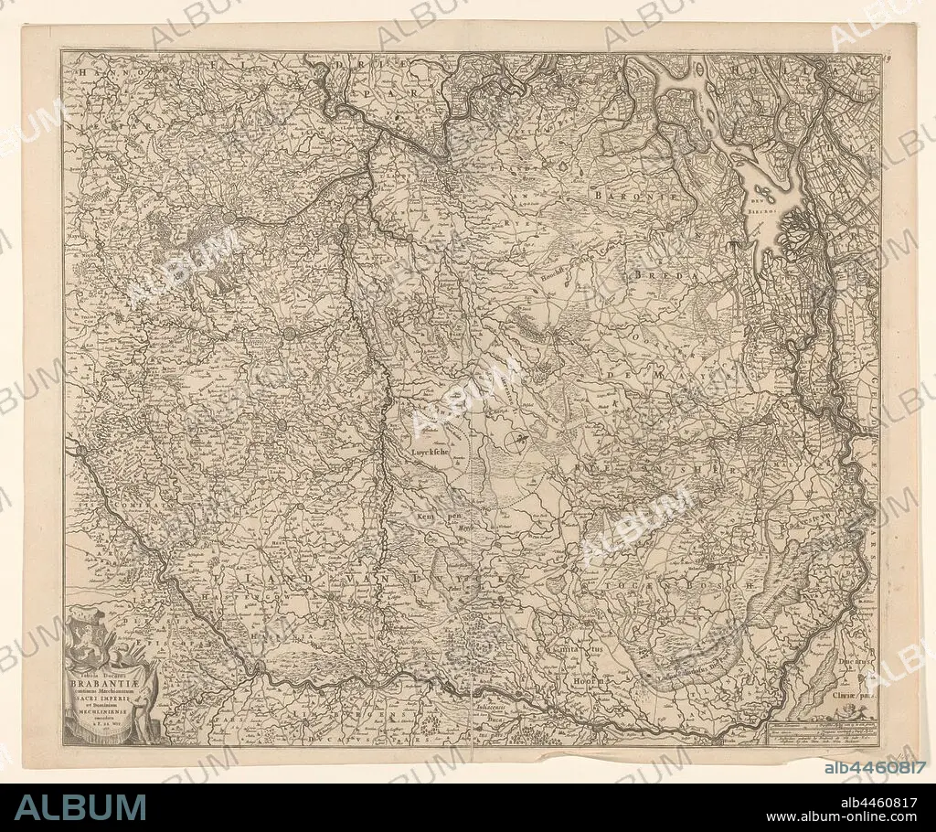
Map of the Duchy of Brabant, Tabula ducatus Brabantiae continens marchionatum sacri imperii and dominium Mechliniense (title on object), Map of Brabant. The north top right, compass rose in the middle. Bottom left cartouche with title, coat of arms, weapons, draperies and putto. Bottom right scale in German miles and Urengaans 'controlling 3 German Miles', maps of separate countries or regions, Brabant, Frederik de Wit, Amsterdam, 1666, paper, engraving, h 49.5 cm × w 54.7 cm.
| Share |
|---|
 Pinterest Pinterest |
 Twitter Twitter |
 Facebook Facebook |
 Copy link Copy link |
 Email Email |
|
Add to another lightbox |
|
Add to another lightbox |


Buy this image.
Select the use:

Caption: Map of the Duchy of Brabant, Tabula ducatus Brabantiae continens marchionatum sacri imperii and dominium Mechliniense (title on object), Map of Brabant. The north top right, compass rose in the middle. Bottom left cartouche with title, coat of arms, weapons, draperies and putto. Bottom right scale in German miles and Urengaans 'controlling 3 German Miles', maps of separate countries or regions, Brabant, Frederik de Wit, Amsterdam, 1666, paper, engraving, h 49.5 cm × w 54.7 cm
Credit: Album / quintlox
Releases: ? Model Release: No - ? Property Release: No
Rights questions?
Rights questions?
Image size: 5860 × 4903 px | 82.2 MB
Print size: 49.6 × 41.5 cm | 2307.1 × 1930.3 in (300 dpi)
Keywords: 1666 • AMSTERDAM • ARMES • ARMS • BOTTOM LEFT CARTOUCHE • BOTTOM RIGHT SCALE • BRABANT • COAT • COMPASS ROSE • DOMINIUM MECHLINIENSE • DRAPERIES • DUCHY • ENGRAVED • ENGRAVING (ARTWORK) • ENGRAVING • ENGRAVING. • ENGRAVINGS • ETCHING • FREDERIK DE WIT • GERMAN MILES • MAP • MAPS • MIDDLE • NORTH TOP RIGHT • OBJECT • OBJECTS • OVERCOAT • PAPER AND PACKAGE PRODUCTS • PAPER • PLAN (CARTOGRAPHY) • PRINT • PUTTO • REGIONS • SEPARATE COUNTRIES • SHELTER • TABULA DUCATUS BRABANTIAE CONTINENS MARCHIONATUM SACRI IMPERII • TITLE • UMBRELLA • URENGAANS 'CONTROLLING 3 GERMAN MILES • WEAPON • WEAPONRY • WEAPONS
