alb9203469
Islamic World and Sea Trade, Map
| Share |
|---|
 Pinterest Pinterest |
 Twitter Twitter |
 Facebook Facebook |
 Copy link Copy link |
 Email Email |
|
Add to another lightbox |
|
Add to another lightbox |


Buy this image.
Select the use:

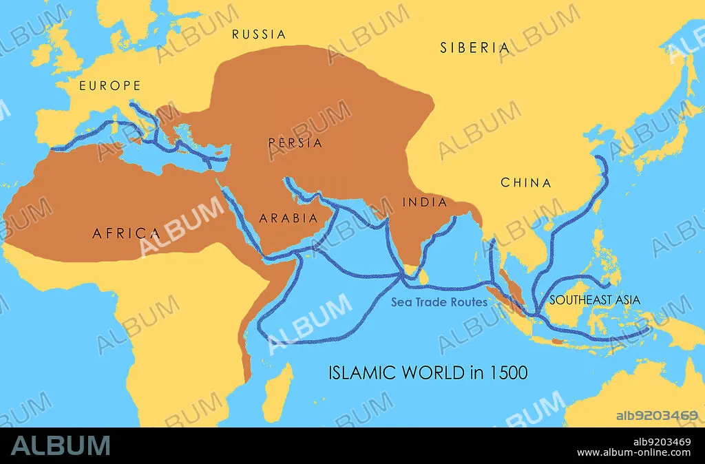
Title: Islamic World and Sea Trade, Map
Caption: A map showing a network of medieval sea trade routes. The areas in darker yellow indicate the extent of the Islamic world in 1500.
Credit: Album / Jessica Wilson / Science Source
Releases: ? Model Release: No - ? Property Release: No
Rights questions?
Rights questions?
Image size: 2868 × 1740 px | 14.3 MB
Print size: 24.3 × 14.7 cm | 1129.1 × 685.0 in (300 dpi)
Keywords: 1500S • 16 16TH XVI XVITH SIXTEENTH CENTURY • 16 CENTURY • 16TH CENTURY • 16TH • AFRICA • AFRICAN CONTINENT • AFRICAN • ARAB • AREAS • ASIA • CENTURY • CHINA • EAST • EUROPE • GLOBAL • INDIA • INDIAN • INFOGRAPHIC • ISLAM • ISLAMIC • LABELED • LAND • MAP • MARITIME • MEDIEVAL • MEDITERRANEAN • MIDDLE • MYTH: PERSIAN • NAUTICAL • ORIENT • PERSIA • PERSIAN ART • PERSIAN MYTH • PERSIAN • ROUTE • SEA • SOUTHEAST • TERRITORY • TRADE • WORLD • XVI CENTURY
