alb4193261
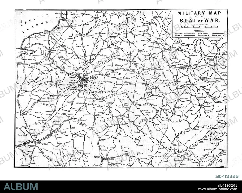
'Military Map of the Seat of War', 1870. Artist: Unknown.
| Share |
|---|
 Pinterest Pinterest |
 Twitter Twitter |
 Facebook Facebook |
 Copy link Copy link |
 Email Email |
|
Add to another lightbox |
|
Add to another lightbox |


Title:
'Military Map of the Seat of War', 1870. Artist: Unknown.
Caption:
'Military Map of the Seat of War', 1870. Map showing northern France, including Paris and the English Channel, during the Franco-Prussian War, (1870-1871). From The Times, 15 November 1870.
Credit:
Album / Heritage Images / The Print Collector
Releases:
Model: No - Property: No
Rights questions?
Rights questions?
Image size:
8100 x 6040 px | 140.0 MB
Print size:
68.6 x 51.1 cm | 27.0 x 20.1 in (300 dpi)
Keywords:
1870-1871 • 19TH CENTURY • B & W • B / W • B&W • BLACK & WHITE • BLACK AND WHITE • BRITAIN • BRITISH • CENTURY • CHANNEL • CONCEPT • COUNTRY • ENGLISH CHANNEL • FRANCE • FRANCO-PRUSSIAN WAR • GEOGRAPHICAL FEATURE • GEOGRAPHY • LOCATION • MAP • MILITARY • MONOCHROMATIC • MONOCHROME • NINETEENTH CENTURY • PARIS • SEA • WAR
