alb3274594
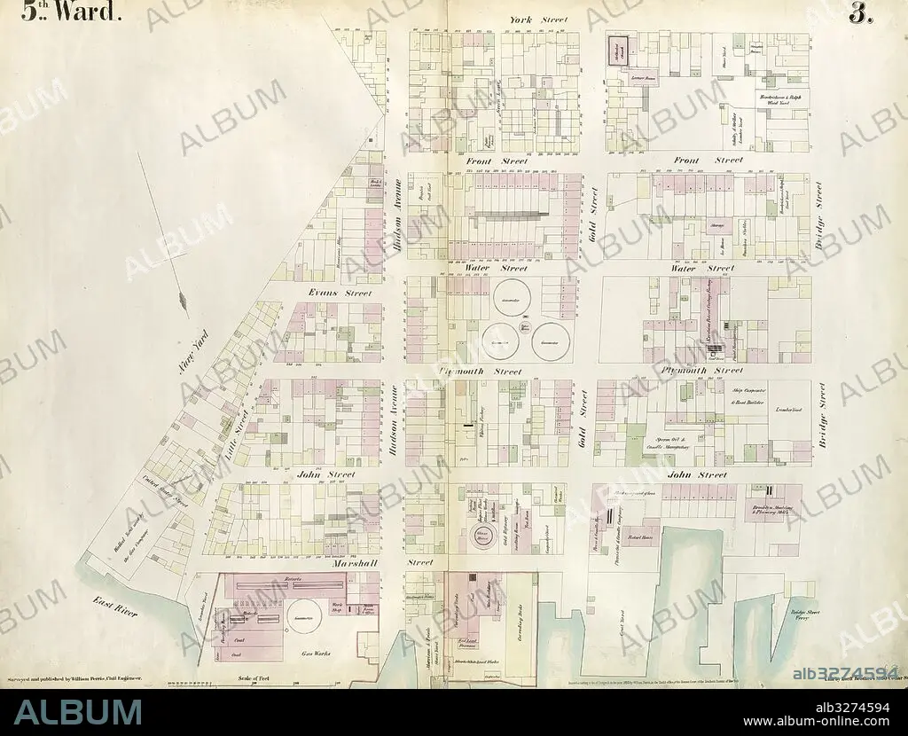
Plate 3: Map bounded by East River, Brooklyn Navy Yard, York Street, Bridge Street. 1855, William Perris, Brooklyn, New York, N.Y., USA.
| Share |
|---|
 Pinterest Pinterest |
 Twitter Twitter |
 Facebook Facebook |
 Copy link Copy link |
 Email Email |
|
Add to another lightbox |
|
Add to another lightbox |


Caption:
Plate 3: Map bounded by East River, Brooklyn Navy Yard, York Street, Bridge Street. 1855, William Perris, Brooklyn, New York, N.Y., USA
Credit:
Album / quintlox
Releases:
Model: No - Property: No
Rights questions?
Rights questions?
Image size:
5956 x 4522 px | 77.1 MB
Print size:
50.4 x 38.3 cm | 19.9 x 15.1 in (300 dpi)
Keywords:
AMERICA • AMERICAS • BRIDGE STREET 1855 • BROOKLYN NAVY YARD • BROOKLYN • CARTOGRAPHIC • CARTOGRAPHY • EAST RIVER • EEUU • GEOGRAPHY • HISTORIC MAP • MANHATTAN, NEW YORK • MAP BOUNDED BY • MAP MAKING • MAP • MAPS • NEW YORK CITY • NEW YORK • NEW YORK, USA • NY • OLD MAP • PLAN (CARTOGRAPHY) • PLATE 3 • U. S. A • UNITED STATES • VINTAGE MAP • WILLIAM PERRIS • YORK STREET
