alb1644476
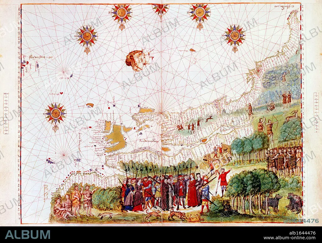
Map of east coast of North America from Labrador to Cape Florida and featuring mouth of St Lawrence. Map of pre-1547 based on Jacques Cartier's discoveries of 1534-1541.
| Share |
|---|
 Pinterest Pinterest |
 Twitter Twitter |
 Facebook Facebook |
 Copy link Copy link |
 Email Email |
|
Add to another lightbox |
|
Add to another lightbox |


Caption:
Map of east coast of North America from Labrador to Cape Florida and featuring mouth of St Lawrence. Map of pre-1547 based on Jacques Cartier's discoveries of 1534-1541
Credit:
Album / Universal History Archive/Universal Images Group
Releases:
Model: No - Property: No
Rights questions?
Rights questions?
Image size:
4500 x 3174 px | 40.9 MB
Print size:
38.1 x 26.9 cm | 15.0 x 10.6 in (300 dpi)
