alb4094448
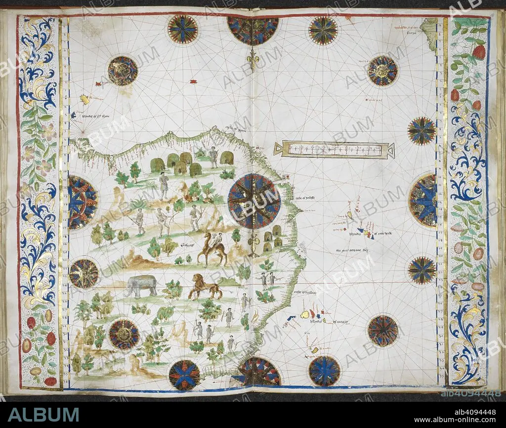
Chart of the western coast of Africa from the Gulf of Guinea to the Straits, with the adjacent isles, and a small part of the coast of South America. Jean Rotz, Boke of Idrography (The 'Rotz Atlas'). c 1535-1542. Source: Royal MS 20 E IX f.17v-18. Language: French & English.
| Share |
|---|
 Pinterest Pinterest |
 Twitter Twitter |
 Facebook Facebook |
 Copy link Copy link |
 Email Email |
|
Add to another lightbox |
|
Add to another lightbox |


Buy this image.
Select the use:

Author: JEAN ROTZ
Caption: Chart of the western coast of Africa from the Gulf of Guinea to the Straits, with the adjacent isles, and a small part of the coast of South America. Jean Rotz, Boke of Idrography (The 'Rotz Atlas'). c 1535-1542. Source: Royal MS 20 E IX f.17v-18. Language: French & English.
Credit: Album / British Library
Releases: ? Model Release: No - ? Property Release: No
Rights questions?
Rights questions?
Image size: 6501 × 5159 px | 96.0 MB
Print size: 55.0 × 43.7 cm | 2559.4 × 2031.1 in (300 dpi)
Keywords: 16 16TH XVI XVITH SIXTEENTH CENTURY • 16 CENTURY • 16TH CENTURY • 16TH • AFRICA • AFRICAN • ANIMAL • ANIMAL: LION • ANIMALS • ARCHIVE • ARCHIVES • BIG CAT • CAMEL • CAMELID • CAMELS • CARTE • CARTOGRAPHIC • CARTOGRAPHY • COAST • COASTAL • COASTLINE • COLOR • COLORS • COLOUR • COLOURS • DOCUMENT • ELEFANT • ELEPHANT • ELEPHANTS • ETHNICITY • FELINAE • FELINE • FLUSH • HUMANS • LEO • LEON • LION • LIONESS • LIONS • MAMMAL • MANUSCRIPT • MAP MAKING • MAP • MAPS • MARITIME • NATIONALITY • ORGANISMS • PEOPLE • PLAN (CARTOGRAPHY) • ROTZ, JEAN • SEACOAST • SEAFRONT • SEASCAPE WITH BEACH • SEASHORE • SEASIDE • SHORELINE • XVI CENTURY
