alb4088841
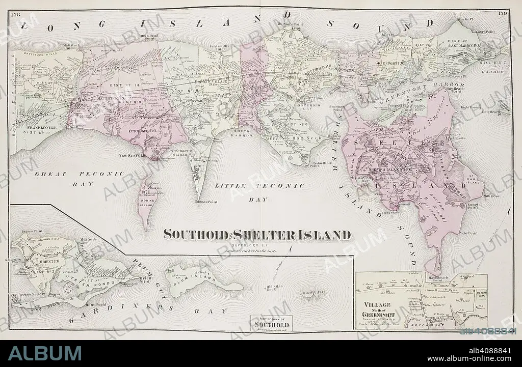
Map of Southold Shelter Island on Long Island New York in the United States. . Atlas of Long Island, New York. From recent and actual Surveys and Records under the superintendence of F.W. Beers. New York, 1873. Source: Maps.33.d.17 ff.178-179. Language: English.
| Share |
|---|
 Pinterest Pinterest |
 Twitter Twitter |
 Facebook Facebook |
 Copy link Copy link |
 Email Email |
|
Add to another lightbox |
|
Add to another lightbox |


Caption:
Map of Southold Shelter Island on Long Island New York in the United States. . Atlas of Long Island, New York. From recent and actual Surveys and Records under the superintendence of F.W. Beers. New York, 1873. Source: Maps.33.d.17 ff.178-179. Language: English.
Credit:
Album / British Library
Releases:
Model: No - Property: No
Rights questions?
Rights questions?
Image size:
6952 x 4532 px | 90.1 MB
Print size:
58.9 x 38.4 cm | 23.2 x 15.1 in (300 dpi)
Keywords:
19 CENTURY • 19TH CENTURY • 19TH • 19TH-CENTURY • ARCHIPELAGO • CARTE • CARTOGRAPHIC • CARTOGRAPHY • DATE BY CENTURY OF WORK OR SCENE • EEUU • ISLA • ISLAND • ISLANDS • LK_KEYWORDS • LONG ISLAND • MANHATTAN, NEW YORK • MAP MAKING • MAP • MAPS • NEW AMSTERDAM • NEW YORK CITY • NEW YORK • NEW YORK, USA • NINETEENTH CENTURY • NORTH AMERICA • NORTH AMERICAN • PLAN (CARTOGRAPHY) • STYLE AND PERIOD • U. S. A • UNITED STATES • US STATES • XIX CENTURY
