alb4284602
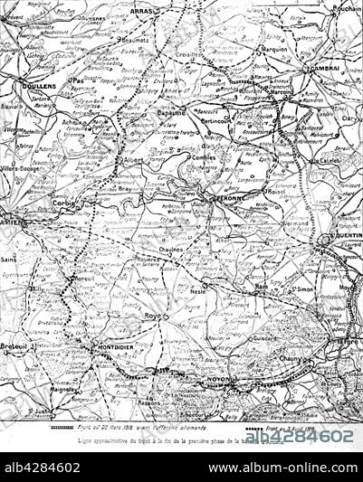
Map pf the Battle of Amiens
| Share |
|---|
 Pinterest Pinterest |
 Twitter Twitter |
 Facebook Facebook |
 Copy link Copy link |
 Email Email |
|
Add to another lightbox |
|
Add to another lightbox |


Buy this image.
Select the use:

Title:
Map pf the Battle of Amiens
Caption:
First World War. . Approximate front line at the end of the first phase of the Battle of Amiens.. The drawn to scale map indicates the line on 20th March 1918 and the dotted line indicates the front to 3 April 1918.
Credit:
Album / Photo12/Archives Snark
Releases:
Model: No - Property: No
Rights questions?
Rights questions?
Image size:
3965 x 4943 px | 56.1 MB
Print size:
33.6 x 41.9 cm | 13.2 x 16.5 in (300 dpi)
Keywords:
1ST WORLD WAR • 20TH CENTURY • ALBERT • ARRAS • BAPAUME • CAMBRAI • CORBIE • FIRST WORLD WAR • FRANCE • MAP • MONTDIDIER • NOYON • PÉRONNE • SAINT-QUENTIN • WORLD WAR I (1914-18) • WORLD WAR I • WORLD WAR ONE • WW1 • WWI
