alb3839198
Tsunami Warning Diagram
| Share |
|---|
 Pinterest Pinterest |
 Twitter Twitter |
 Facebook Facebook |
 Copy link Copy link |
 Email Email |
|
Add to another lightbox |
|
Add to another lightbox |


Title:
Tsunami Warning Diagram
Caption:
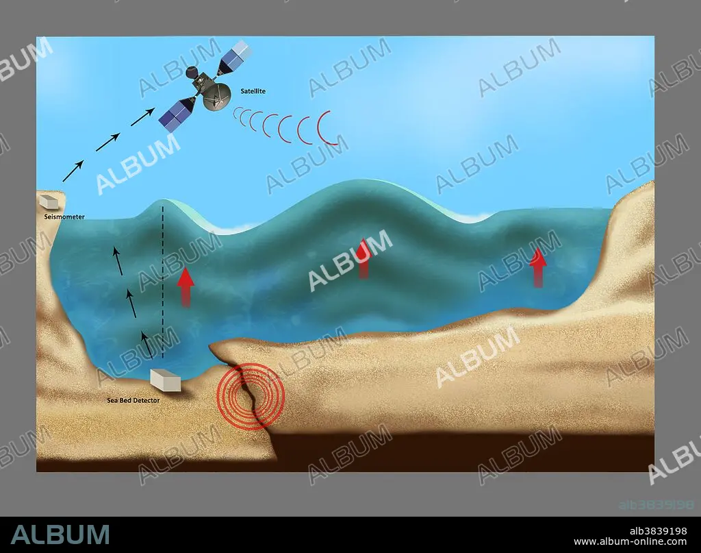
Illustration outlining a tsunami forming, caused by collision of the seabed during an earthquake circled in red. Equipment used to detect a forming tsunami includes a sea bed detector on the bottom left, a seismometer on the upper left and a satellite shown in the sky above the water. Red arrows indicate the upward movement of the ocean water.
Credit:
Album / Science Source / Gwen Shockey
Releases:
Model: No - Property: No
Rights questions?
Rights questions?
Image size:
4350 x 3205 px | 39.9 MB
Print size:
36.8 x 27.1 cm | 14.5 x 10.7 in (300 dpi)
Keywords:
BANK • BANKS • BREAK • CATASTROPHE • CAUSE • COLLISION • CRASH • DIAGRAM • DISASTER • EARTH QUAKE • EARTHQUAKE • ECO SYSTEM • ECOLOGY • ENVIRONMENT • ENVIRONMENTAL • EXPLAIN • EXPLAINING • EXPLANATION • FLEET • FORM • FORMATION • FRICTION • LANDSCAPE • LANDSCAPES • MARINE • NAVY • OCEAN • RIPPLE • SAND • SATELLITE • SCIENCE • SEA BED DETECTOR • SEA BED • SEA • SEABED • SEAS • SEISMOMETER • SKY • SMASH-UP • STORM • TSUNAMI • TSUNAMIS • WARN • WARNING • WATER • WAVE • WAVES • WEATHER
