alb1962708
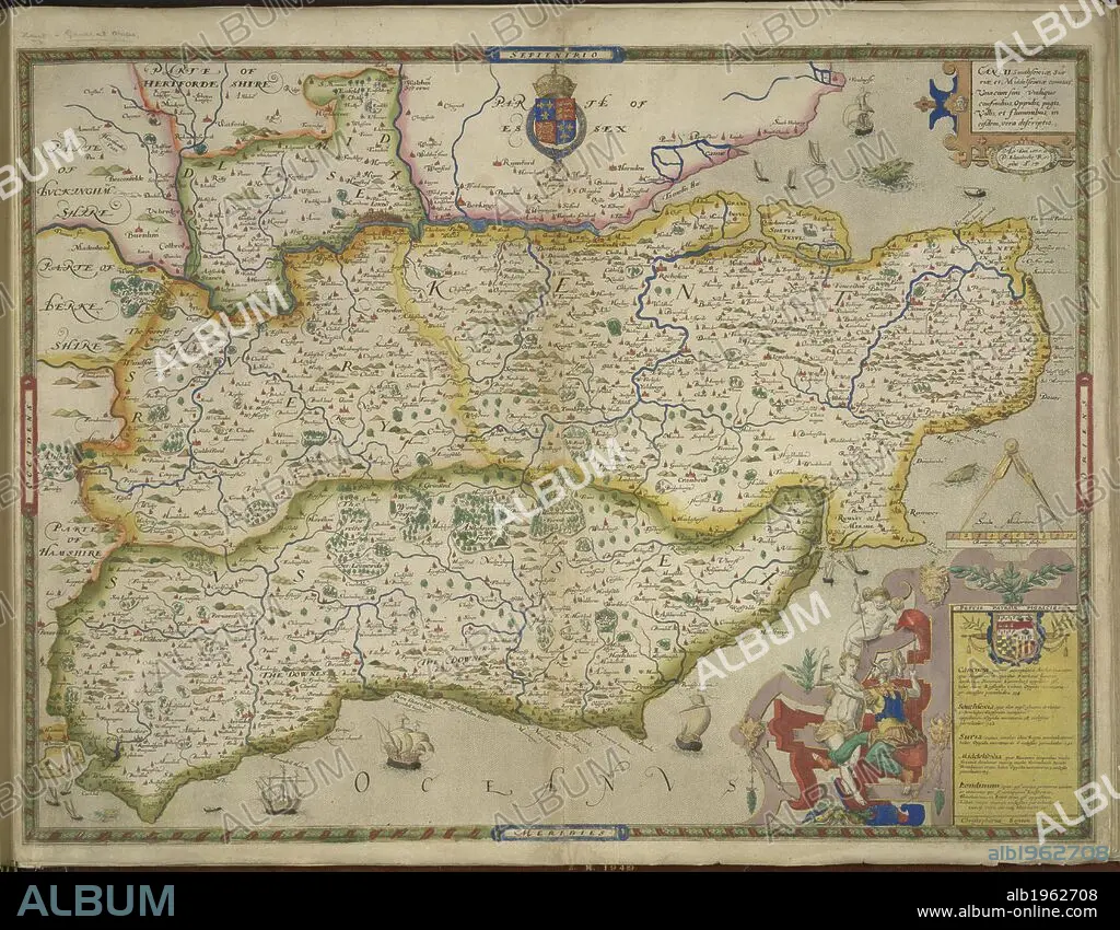
Sussex and Kent. An atlas of England and Wales, containing 35 colou. London, 1579. A map of Sussex and Kent, with parts of Essex, Buckinghamshire, Bekshire, Hampshire and Middlesex. Image taken from An atlas of England and Wales, containing 35 coloured maps, drawn by Christopher Saxton and engraved by A. Ryther, R. Hogenberg, C. Hogius, N. Reynolds, L. Terwoort and F. Scatter. Originally published/produced in 1579. Source: Maps.C.3.bb.5, f.11. Language: English.
| Share |
|---|
 Pinterest Pinterest |
 Twitter Twitter |
 Facebook Facebook |
 Copy link Copy link |
 Email Email |
|
Add to another lightbox |
|
Add to another lightbox |


Buy this image.
Select the use:

Caption:
Sussex and Kent. An atlas of England and Wales, containing 35 colou. London, 1579. A map of Sussex and Kent, with parts of Essex, Buckinghamshire, Bekshire, Hampshire and Middlesex. Image taken from An atlas of England and Wales, containing 35 coloured maps, drawn by Christopher Saxton and engraved by A. Ryther, R. Hogenberg, C. Hogius, N. Reynolds, L. Terwoort and F. Scatter. Originally published/produced in 1579. Source: Maps.C.3.bb.5, f.11. Language: English.
Credit:
Album / British Library
Releases:
Model: No - Property: No
Rights questions?
Rights questions?
Image size:
5784 x 4503 px | 74.5 MB
Print size:
49.0 x 38.1 cm | 19.3 x 15.0 in (300 dpi)
Keywords:
BERKS • BERKSHIRE • BRITAIN • BRITISH ISLES • BUCKINGHAMSHIRE • CARTE • CARTOGRAPHY • ENGLAND'S • ENGLAND • EUROPA • EUROPE • GREAT BRITAIN • GREAT-BRITAIN • KENT • KENT. • MAP MAKING • MAP • MAPS • PLAN (CARTOGRAPHY) • SUSSEX • U. K. • UNITED KINGDOM • WESTERN EUROPE
