alb4087548
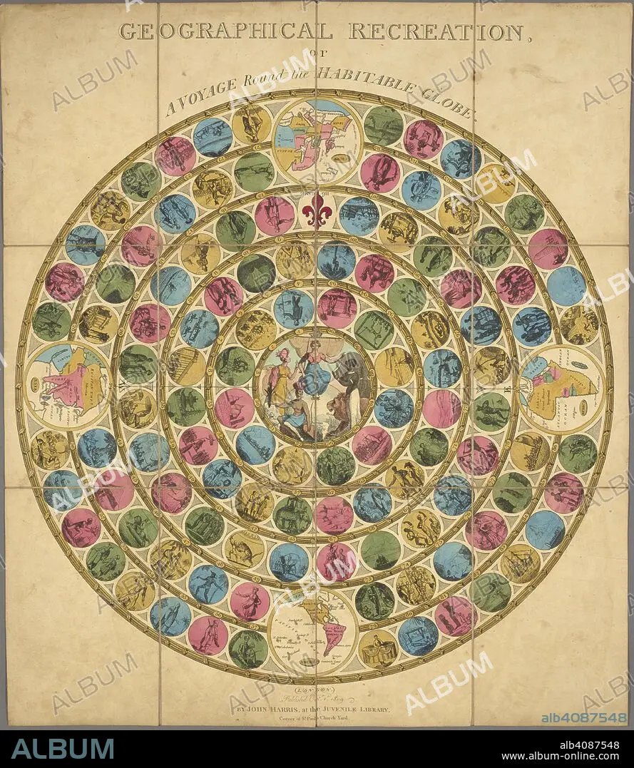
An illustrated circular diagram for the purposes of a game. Geographical recreation or a voyage round the habitable globe. London : John Harris at the Juvenile Library, Oct 1st 1809. Board game representing world travel and including 4 maps of continents. Previously owned and donated by Waddington plc. Physical Description: 1 game : col ; 50 cm. diam., on sheet 64 x 51 cm, fold. to 20 x 13 cm, in slipcase.; Scale indeterminable. Source: Maps.C.43.b.68.
| Share |
|---|
 Pinterest Pinterest |
 Twitter Twitter |
 Facebook Facebook |
 Copy link Copy link |
 Email Email |
|
Add to another lightbox |
|
Add to another lightbox |


Buy this image.
Select the use:

Author:
Caption:
An illustrated circular diagram for the purposes of a game. Geographical recreation or a voyage round the habitable globe. London : John Harris at the Juvenile Library, Oct 1st 1809. Board game representing world travel and including 4 maps of continents. Previously owned and donated by Waddington plc. Physical Description: 1 game : col ; 50 cm. diam., on sheet 64 x 51 cm, fold. to 20 x 13 cm, in slipcase.; Scale indeterminable. Source: Maps.C.43.b.68.
Credit:
Album / British Library
Releases:
Image size:
4284 x 4932 px | 60.4 MB
Print size:
36.3 x 41.8 cm | 14.3 x 16.4 in (300 dpi)
Keywords:
19 CENTURY • 19TH CENTURY • 19TH CENTURY. • 19TH • 19TH-CENTURY • CARTE • CARTOGRAPHIC • CARTOGRAPHY • CIRCLE • CIRCULAR SHAPE • CIRCULAR • CIRCULATE • COLOR • COLORS • COLOUR • COLOURS • CURIOSITY • CURIOUS • FLUSH • FORMS (GEOMETRIC) • GAME • HARRIS, JOHN • LEISURE ACTIVITIES • LEISURE ACTIVITY • MAP MAKING • MAP • MAPS • NINETEENTH CENTURY • NOSINESS • NOSY • PLAN (CARTOGRAPHY) • RECREATION • ROUND • SHAPE • SHAPES • XIX CENTURY
