alb4088690
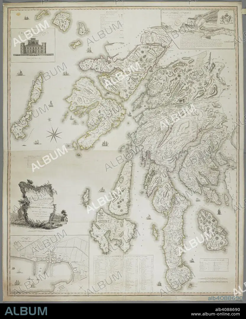
A map of Argyllshire. Map of Argyllshire, taken from actual survey, by G. Langlands and Son. Campbeltown, 1801. Source: Maps K.Top.49.25.2 TAB END. Language: English.
| Share |
|---|
 Pinterest Pinterest |
 Twitter Twitter |
 Facebook Facebook |
 Copy link Copy link |
 Email Email |
|
Add to another lightbox |
|
Add to another lightbox |


Buy this image.
Select the use:

Caption: A map of Argyllshire. Map of Argyllshire, taken from actual survey, by G. Langlands and Son. Campbeltown, 1801. Source: Maps K.Top.49.25.2 TAB END. Language: English.
Credit: Album / British Library
Releases: ? Model Release: No - ? Property Release: No
Rights questions?
Rights questions?
Image size: 6095 × 7500 px | 130.8 MB
Print size: 51.6 × 63.5 cm | 2399.6 × 2952.8 in (300 dpi)
Keywords: 19 CENTURY • 19TH CENTURY • 19TH CENTURY. • 19TH • 19TH-CENTURY • ALBION • ARGYLLSHIRE • BRITAIN • BRITISH ISLES • CARTE • CARTOGRAPHIC • CARTOGRAPHY • ENGLAND'S • ENGLAND • GREAT BRITAIN • GREAT-BRITAIN • MAP MAKING • MAP • MAPS • NINETEENTH CENTURY • PLAN (CARTOGRAPHY) • SCOTLAND UNITED KINGDOM • SCOTLAND • U. K. • UNITED KINGDOM • XIX CENTURY
