alb5404375
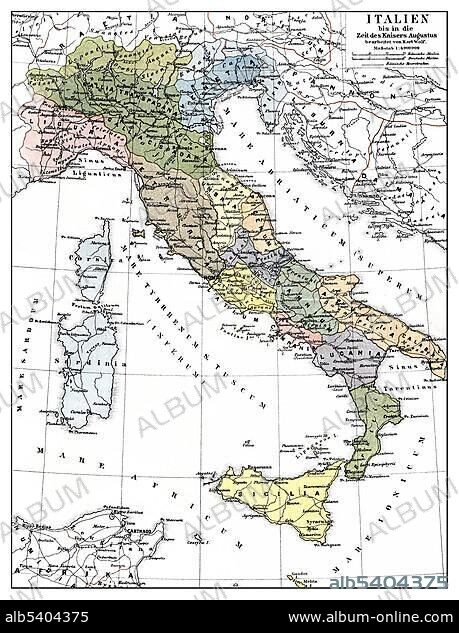
Historic illustration, map of Italy frome the times of Emperor Augustus, 1st Century, 19th century, Meyers Konversations-Lexikon encyclopedia, 1889.
| Share |
|---|
 Pinterest Pinterest |
 Twitter Twitter |
 Facebook Facebook |
 Copy link Copy link |
 Email Email |
|
Add to another lightbox |
|
Add to another lightbox |


Buy this image.
Select the use:

Caption:
Historic illustration, map of Italy frome the times of Emperor Augustus, 1st Century, 19th century, Meyers Konversations-Lexikon encyclopedia, 1889
Credit:
Album / ImageBroker / H.-D. Falkenstein
Releases:
Model: No - Property: No
Rights questions?
Rights questions?
Image size:
459 x 600 px | 806.8 KB
Print size:
3.9 x 5.1 cm | 1.5 x 2.0 in (300 dpi)
Keywords:
19TH CENTURY • AGE • ÂGÉS • AUGUSTUS • AUS • BOOK • BOOKING • BOOKS • CADRE • CARD • CARDBOARD • CARDS • CHARTS • DEPICTION • DEPICTIONS • DRAWING • DRAWINGS • EMPEROR • EMPERORS • ENCYCLOPEDIA • ENCYLOPEDIAS • EUROPE • FIGURE • FIGURES • GEOGRAPHIC • GEOGRAPHICAL • GEOGRAPHY • HISTORIC • HISTORICAL • HISTORY • ILLUSTRATION • ILLUSTRATIONS • IMAGE MOTIF • IMAGES • IN PAINTINGS • INTERIORS: IN PAINTINGS • ITALIA • ITALY • LABOR • LABOUR • MAP • MAPS • MEYERS KONVERSATIONS-LEXIKON • MEYERS LEXIKON • NINETEENTH CENTURY • OCTAVIAN • OCTAVIUS • OLD AGE • OLD • PAINTING (ACTIVITY) • PAINTING • PAINTINGS • PICTURE • PICTURES • REFERENCE BOOK • REFERENCE BOOKS • ROAD MAP • ROAD MAPS • SKETCH • SKETCHES • TIME • WORK • WORKING • WORKS
