alb6167243
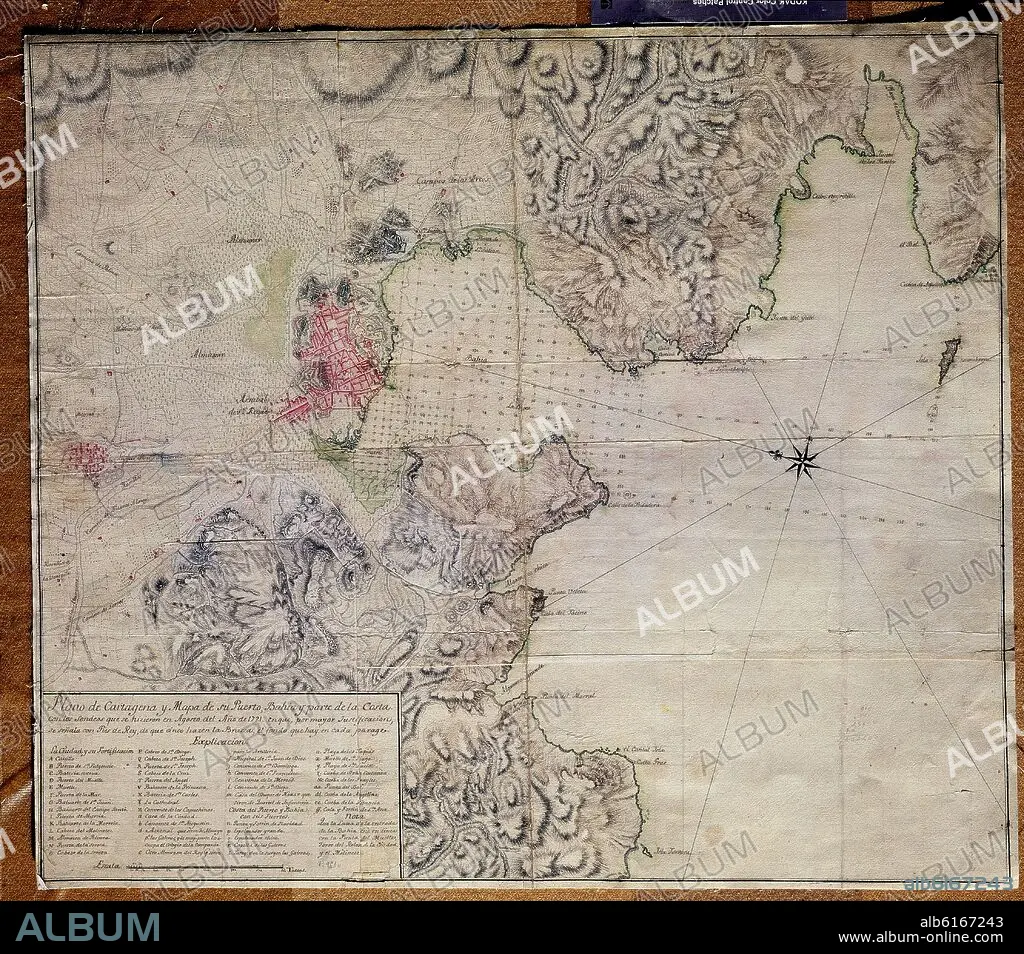
PLANO DE CARTAGENA Y MAPA DE SU PUERTO - 1721
| Share |
|---|
 Pinterest Pinterest |
 Twitter Twitter |
 Facebook Facebook |
 Copy link Copy link |
 Email Email |
|
Add to another lightbox |
|
Add to another lightbox |


Buy this image.
Select the use:

Caption:
Automatic translation: PLAN OF CARTAGENA AND MAP OF ITS PORT - 1721
PLANO DE CARTAGENA Y MAPA DE SU PUERTO - 1721
Location:
Credit:
Album / Oronoz
Releases:
Model: No - Property: No
Rights questions?
Rights questions?
Image size:
4455 x 3920 px | 50.0 MB
Print size:
37.7 x 33.2 cm | 14.8 x 13.1 in (300 dpi)
Keywords:
