alb9657435
map, geography, American Civil War, Richmond, Washington DC, historical,
| Share |
|---|
 Pinterest Pinterest |
 Twitter Twitter |
 Facebook Facebook |
 Copy link Copy link |
 Email Email |
|
Add to another lightbox |
|
Add to another lightbox |


Buy this image.
Select the use:

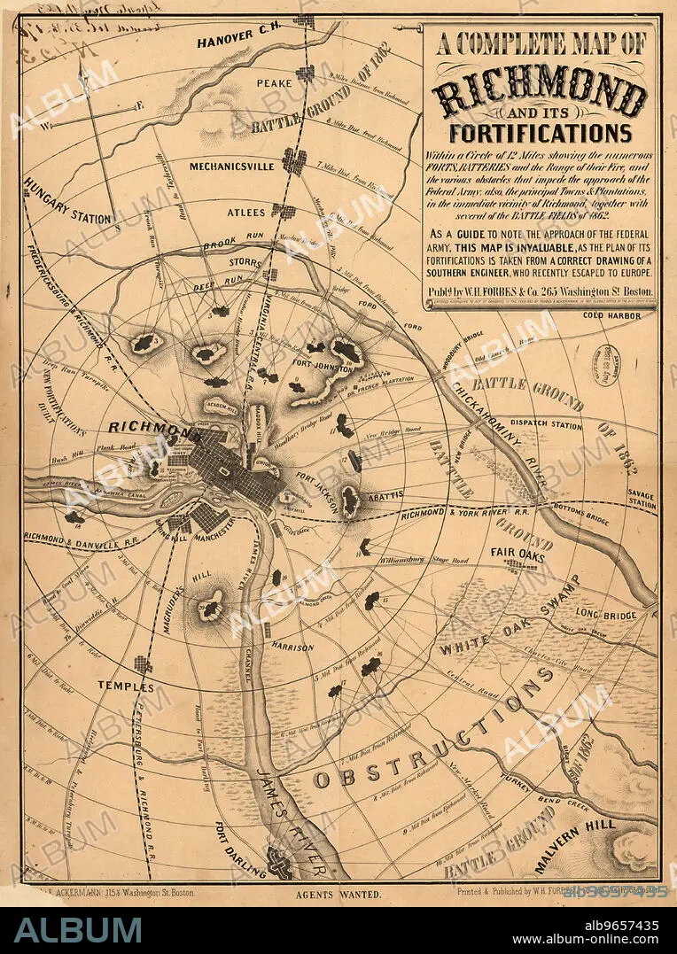
Title: map, geography, American Civil War, Richmond, Washington DC, historical,
Caption: A Complete Map of Richmond and its Fortifications, American Civil War, Published by William H. Forbes & Co., 1863
Credit: Album / Universal Images Group / Circa Images
Releases: ? Model Release: No - ? Property Release: No
Rights questions?
Rights questions?
Image size: 3650 × 4891 px | 51.1 MB
Print size: 30.9 × 41.4 cm | 1437.0 × 1925.6 in (300 dpi)
Keywords: 1860'S • 1860-1869 • 1863 • 19 CENTURY • 19TH CENTURY • 19TH CENTURY. • 19TH • 19TH-CENTURY • AMERICAN CIVIL WAR • AMERICAN HISTORY • CIRCA • COLOR • COLOUR • EE. UU. • EEUU • ESTADOS UNIDOS USA EEUU EE. UU. EUA E. U. A. • FLUSH • FORTIFICATIONS • GEOGRAFIA • GEOGRAPHY • GHIV • GUERRA • HISTORICAL • HUNDRED YEARS WAR • ILLUSTRATION • ILLUSTRATIONS • ILUSTRATION • MAP • MAPS • NINETEENTH CENTURY • NO ONE • NO PEOPLE • NO-ONE • NOBODY • PLAN (CARTOGRAPHY) • RETRO • RICHMOND • U S A • U. S. A • U. S. A. • U. S. HISTORY • U.S. • UNITED STATES AMERICA • UNITED STATES OF AMERICA • UNITED STATES • UNITED STATES, THE • UNITES STATES OF AMERICA USA • US-AMERICAN • USA • USA. UNITED STATES • VERTICAL LINES • VERTICAL • VINTAGE • VIRGINIA • WAR • WARFARE • WARS • WITHOUT PEOPLE • XIX CENTURY
