alb9435044
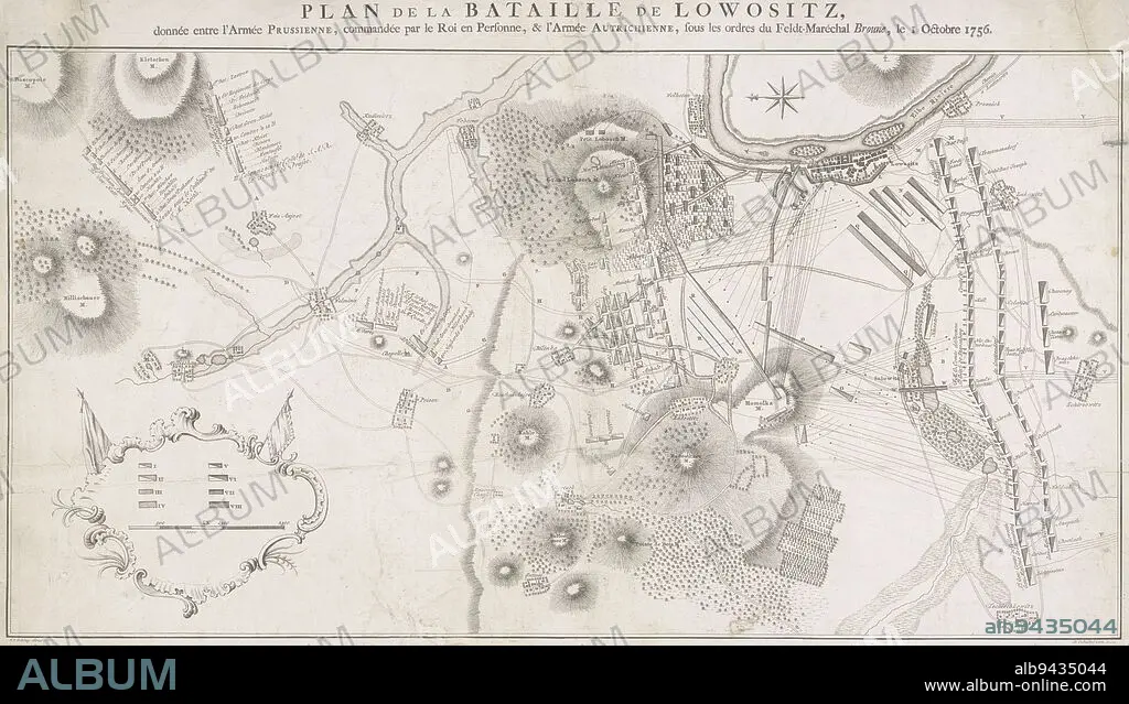
Military map of Lobositz Czech Republic showing the battle of 1 October 1756 between the Prussians and the Austrians This battle was the opening battle of the Seven Years' War 1756-1763, Military Map of Lobositz Plan de la Bataille de Lowositz , Jacob van der Schley, (mentioned on object), intermediary draughtsman: de Oebschelwitz, (mentioned on object), publisher: Pieter de Hondt, (mentioned on object), Amsterdam, publisher: The Hague, 1758, paper, etching, h 651 mm × w 464 mm.
| Share |
|---|
 Pinterest Pinterest |
 Twitter Twitter |
 Facebook Facebook |
 Copy link Copy link |
 Email Email |
|
Add to another lightbox |
|
Add to another lightbox |


Caption:
Military map of Lobositz Czech Republic showing the battle of 1 October 1756 between the Prussians and the Austrians This battle was the opening battle of the Seven Years' War 1756-1763, Military Map of Lobositz Plan de la Bataille de Lowositz , Jacob van der Schley, (mentioned on object), intermediary draughtsman: de Oebschelwitz, (mentioned on object), publisher: Pieter de Hondt, (mentioned on object), Amsterdam, publisher: The Hague, 1758, paper, etching, h 651 mm × w 464 mm
Credit:
Album / quintlox
Releases:
Model: No - Property: No
Rights questions?
Rights questions?
Image size:
7158 x 4095 px | 83.9 MB
Print size:
60.6 x 34.7 cm | 23.9 x 13.7 in (300 dpi)
Keywords:
1 OCTOBER 1756 • 1758 • AMSTERDAM • AUSTRIANS • BATTLE • COMBAT • DE OEBSCHELWITZ • DISPUTE • ETCHING • FIGHT • FIGHTING • H 651 MM × W 464 MM • HAGUE • INTERMEDIARY DRAUGHTSMAN • JACOB VAN DER SCHLEY • LOBOSITZ CZECH REPUBLIC SHOWING • LOBOSITZ PLAN DE LA BATAILLE DE LOWOSITZ • MENTIONED • MILITARY MAP • OBJECT • OBJECTS • OPENING BATTLE • PAPER AND PACKAGE PRODUCTS • PAPER • PIETER DE HONDT • PRUSSIANS • PUBLISHER • SCUFFLE • SEVEN YEARS' WAR 1756-1763 • STRUGGLE • UMBRELLA
