alb6165918
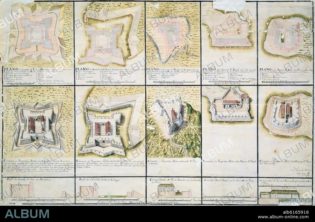
JUAN DE HERRERA SOTOMAYOR. MAPS OF THE CASTLE OF CARTAGENA DE INDIAS - 18TH CENTURY.
 Pinterest
 Twitter
 Facebook
 Copy link
 Email
Email


Title:
MAPS OF THE CASTLE OF CARTAGENA DE INDIAS - 18TH CENTURY.
Caption:
MAPS OF THE CASTLE OF CARTAGENA DE INDIAS - 18TH CENTURY
Location:
Credit:
Album / Oronoz
Releases:
Model: No - Property: No
Rights questions?
Rights questions?
Image size:
6416 x 4206 px | 77.2 MB
Print size:
54.3 x 35.6 cm | 21.4 x 14.0 in (300 dpi)
Keywords:
18TH CENTURY • 18TH CENTURY, THE • 18TH • ARMY GEOGRAPHICAL SERVICE • CASTLE • CITADEL • CITY WALL • CITYWALL • COLOMBIA • FORTIFICATION • FORTIFICATION: CITY WALL • FORTRESS • HERRERA SOTOMAYOR JUAN • HIGH WALL • MADRID • MANUSCRIPT • MANUSCRIPTS • PLAN • SERVICIO GEOGRAFICO DEL EJERCITO • SPAIN • STRENGTH • WALL
