alb2204958
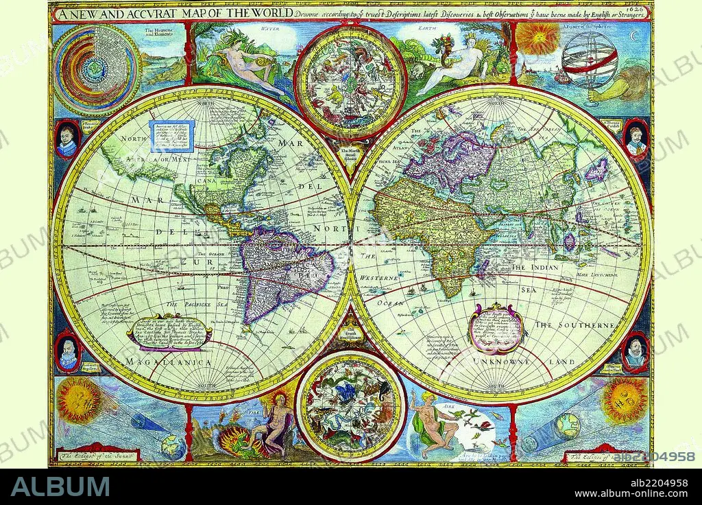
New & Accurate Map of the World; a Stereographic Projection 1646
| Share |
|---|
 Pinterest Pinterest |
 Twitter Twitter |
 Facebook Facebook |
 Copy link Copy link |
 Email Email |
|
Add to another lightbox |
|
Add to another lightbox |


Buy this image.
Select the use:

Title:
New & Accurate Map of the World; a Stereographic Projection 1646
Caption:
English cartographer, historian and antiquary. Born Farndon in Cheshire and a member of the guild of Merchant Tailors. His subsequent cartographic career evolved from his interests as both historian and antiquary. Speed is of considerable importance in the history of English cartography in being the author of two major folio Atlases. The Theatre of the Empire of Great Britaine, an Atlas of the British Isles and its regions, first published in London in 1611. This Atlas is best known for the fine county maps, modeled on the earlier Elizabethan surveys of Christopher Saxton and John Norden, which include armorials, local vignettes, and inset town plans (many of which Speed claimed to have surveyed at first hand himself). His second Atlas, the first World Atlas by an Englishman, entitled A Prospect of the Most Famous Parts of the World, first appeared in London in 1627. It took as its model the Dutch carte-a-figure genre (maps with top and side borders panels of town views and native inhabitants) to portray the countries of the then-known World.
Credit:
Album / Universal Images Group / Universal History Archive/UIG
Releases:
Model: No - Property: No
Rights questions?
Rights questions?
Image size:
4041 x 2694 px | 31.1 MB
Print size:
34.2 x 22.8 cm | 13.5 x 9.0 in (300 dpi)
Keywords:
1646 • ANTIQUE • ATLAS • BANNER • CARTOGRAPHERS • CARTOGRAPHIC • CARTOGRAPHY • CATHOLIC • COUNTER REFORMATION • EXPLORERS • FLAG • ICONOGRAPHY • JESUIT ORDER • JESUIT • JESUITAS • JESUITS • MAP MAKING • MAP • MAPMAKERS • MAPS • MERCATOR • MONKS, JESUIT • NAVIGATION • ORDER, JESUIT • PENNANTS • PLAN (CARTOGRAPHY) • PROJECTION • REFORMATION • SECOND-HAND BOOKSHOP • SHIP • USED BOOK STORE • WORLD
