alb4945512
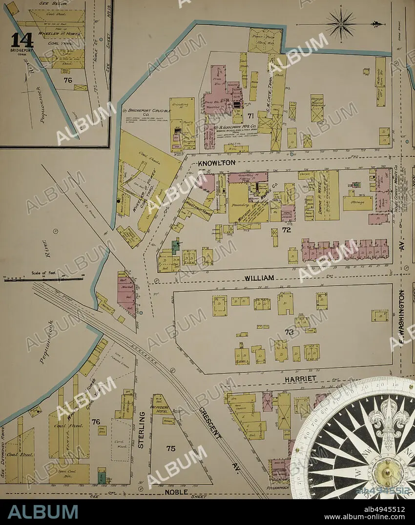
Image 14 of Sanborn Fire Insurance Map from Bridgeport, Fairfield County, Connecticut. 1889. 37 Sheet(s). Bound, America, street map with a Nineteenth Century compass.
| Share |
|---|
 Pinterest Pinterest |
 Twitter Twitter |
 Facebook Facebook |
 Copy link Copy link |
 Email Email |
|
Add to another lightbox |
|
Add to another lightbox |


Buy this image.
Select the use:

Caption: Image 14 of Sanborn Fire Insurance Map from Bridgeport, Fairfield County, Connecticut. 1889. 37 Sheet(s). Bound, America, street map with a Nineteenth Century compass
Credit: Album / quintlox
Releases: ? Model Release: No - ? Property Release: No
Rights questions?
Rights questions?
Image size: 5000 × 6022 px | 86.1 MB
Print size: 42.3 × 51.0 cm | 1968.5 × 2370.9 in (300 dpi)
Keywords: 1889 • 37 SHEET (S) • AMERICA • AMERICA. • AMERICAS • AMERICAS, THE • ATLAS • BOUND • BRIDGEPORT • CARTOGRAPHY • CITIES • CITY • CIUDAD • CONNECTICUT • EEUU • FAIRFIELD COUNTY • GEOGRAFIA • GEOGRAPHY • IMAGE 14 • JOURNEY • JOURNEYMAN'S TRAVEL • JOURNEYMAN'S TRAVELS • LANDMARK • LEISURE • MAP MAKING • NINETEENTH CENTURY COMPASS • OLD • OUTDOOR • OUTDOORS • OUTSIDE • ROAD • ROADS • RUA • SANBORN FIRE INSURANCE MAP • STREET MAP • STREET • STREETS • THRIP • TO TRAVEL • TOWN • TOWNS • TRAVEL • TRAVELING • TRAVELS • TRIP • TRIPS • U S A • U. S. A • U. S. A. • UNITED STATES AMERICA • UNITED STATES OF AMERICA • UNITED STATES • URBAN • US-AMERICAN • USA • USA. UNITED STATES • VIA • VINTAGE • VOYAGE • WAY
