alb9635617
JOHN DOWER. Plan of Constantinople and its Suburbs, 1856. Creator: John Dower.
| Share |
|---|
 Pinterest Pinterest |
 Twitter Twitter |
 Facebook Facebook |
 Copy link Copy link |
 Email Email |
|
Add to another lightbox |
|
Add to another lightbox |


Buy this image.
Select the use:

Author:
Title:
Plan of Constantinople and its Suburbs, 1856. Creator: John Dower.
Caption:
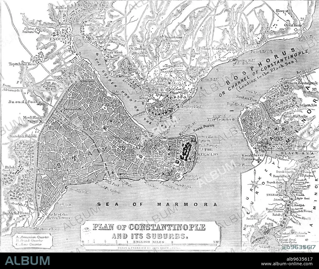
Plan of Constantinople and its Suburbs, 1856. Map showing the city of Constantinople (modern Istanbul, Turkey), including the 'Golden Horn or the Port'; the Bosphorus 'or Channel of Constantinople, leading to the Black Sea'; the Sea of Marmora, the 'Armenian, Frank and Jews' Quarters, pontoon bridge and the Seraglio. From "Illustrated London News", 1856.
Credit:
Album /Heritage Images
Releases:
Image size:
3607 x 2863 px | 29.5 MB
Print size:
30.5 x 24.2 cm | 12.0 x 9.5 in (300 dpi)
Keywords:
19 CENTURY • 19TH CENTURY • 19TH CENTURY. • 19TH • 19TH-CENTURY • ASIA MINOR • B & W • B / W • B W • B&W • BLACK & WHITE • BLACK AND WHITE • BOSPHORUS • BRITAIN • BRITISH • CENTURY • CITY • COAST • COASTAL • COASTLINE • COLOR • COLOUR • CONSTANTINOPLE • COUNTRY • DOWER • DOWER, JOHN • ENGRAVED • ENGRAVING • FLUSH • GEOGRAFIA • GEOGRAPHICAL FEATURE • GEOGRAPHY • GOLDEN HORN • ILLUSTRATED LONDON NEWS • ILN • ISTANBUL • J. DOWER • J. • JOHN DOWER • JOHN JAMES DOWER • JOHN JAMES • JOHN • LOCATION • MAP • MARITIME • NEWSPAPER • NEWSPAPERS • NINETEENTH CENTURY • PRESS • PRINT COLLECTOR, THE • SEA OF MARMARA • SEA • SEASHORE • SEASIDE • SHORELINE • STAMBOUL • STRAIT OF ISTANBUL • STRAIT • TURKEY • TURKISH • WHITE AND BLACK • XIX CENTURY
