alb2215120
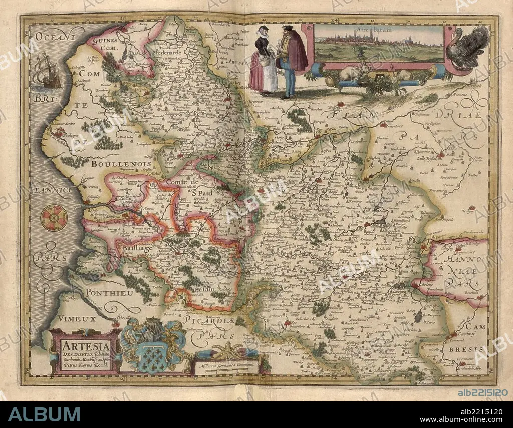
Map of the area around Arras, France 1622 1622
| Share |
|---|
 Pinterest Pinterest |
 Twitter Twitter |
 Facebook Facebook |
 Copy link Copy link |
 Email Email |
|
Add to another lightbox |
|
Add to another lightbox |


Buy this image.
Select the use:

Title:
Map of the area around Arras, France 1622 1622
Caption:
Arras was founded on the hill of Baudimont by the Belgic tribe of the Atrebates, who named it Nemetacum or Nemetocenna in reference to a nemeton (sacred grove) that probably existed there. It was later renamed Atrebatum by the Romans, under whom it became an important garrison town. The town of Atrebatum is pictured in elevation as an inset.
Credit:
Album / Universal Images Group / Universal History Archive/UIG
Releases:
Image size:
7630 x 5979 px | 130.5 MB
Print size:
64.6 x 50.6 cm | 25.4 x 19.9 in (300 dpi)
Keywords:
1622 • AMSTERDAM • ANATOMY: SKULL • ANIMAL: LION • ATLAS • BONES • BOOKS • BURGERS • CADEUCIUS • CARTOGRAPHIC • CARTOGRAPHY • COMPASS • CRANEO • CRANEOS • CRANIUM • CRANIUMS • DUTCH • EXPLORATION • GERMANY • HOLLAND • JEHOVAH • KEERE • LEO • LEON • LION • LIONS • MANUSCRIPTS • MAP MAKING • MAP • MAPMAKERS • MAPS • MERCURIO • MERCURIUS • MERCURY • MERURY • NAVIGATOR • NETHERLANDISH • PALMS • PLAN (CARTOGRAPHY) • RAYS • REMAINS (SKELETON) • SAILING • SCROLLS • SHIP • SHIPS BOW • SHIPS • SKULL • SKULL, ANATOMY • SKULLS • SOL • STAFFS • SUN • SUNBEAM • SUNDIAL • SUNSHINE • YAWEH
