alb8369703
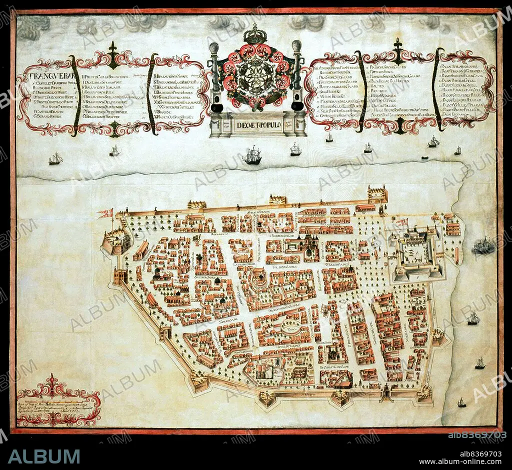
India / Denmark: Map of Tranquebar (Tharangambadi) showing Fort Dansborg, Giorf af Gregers,1733, The Royal Library, Copenhagen
| Compartir |
|---|
 Pinterest Pinterest |
 Twitter Twitter |
 Facebook Facebook |
 Copiar enlace Copiar enlace |
 Email Email |
|
Añadir a otro lightbox |
|
Añadir a otro lightbox |


¿Ya tienes cuenta? Iniciar sesión
¿No tienes cuenta? Regístrate
Compra esta imagen.
Selecciona el uso:

Título: India / Denmark: Map of Tranquebar (Tharangambadi) showing Fort Dansborg, Giorf af Gregers,1733, The Royal Library, Copenhagen
Descripción: Ver traducción automática
Tharangambadi, formerly Tranquebar, is a town in the Nagapattinam district of the Indian state of Tamil Nadu. It lies 15 kilometres (9.3 mi) north of Karaikal, near the mouth of a distributary of the Kaveri River.
. It was a Danish colony from 1620 to 1845, and in Danish it is still known as Trankebar.
Crédito: Album / Universal Images Group / Pictures From History
Autorizaciones: ? Cesión de modelo: No - ? Cesión de propiedad: No
¿Preguntas relacionadas con los derechos?
¿Preguntas relacionadas con los derechos?
Tamaño imagen: 4700 × 4073 px | 54.8 MB
Tamaño impresión: 39.8 × 34.5 cm | 1850.4 × 1603.5 in (300 dpi)
Palabras clave: 1733 • CARTOGRAFIA • COLONIALISMO • COMERCIO • DANES • DANESA • DINAMARCA • GRAFICO • IMPERIALISMO • INDIA • INDIO • MAPA • MAPAS • S. XVIII • SIGLO XVIII • TAMIL NADU • TARJETAS
