alb5400279
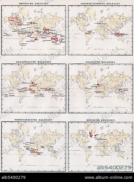
Historic illustration, world maps showing the colonies of Great Britain, Netherlands, France, Spain, Portugal and Denmark, 19th century, Meyers Konversations-Lexikon encyclopedia, 1889, Europe.
| Compartir |
|---|
 Pinterest Pinterest |
 Twitter Twitter |
 Facebook Facebook |
 Copiar enlace Copiar enlace |
 Email Email |
|
Añadir a otro lightbox |
|
Añadir a otro lightbox |


¿Ya tienes cuenta? Iniciar sesión
¿No tienes cuenta? Regístrate
Compra esta imagen

Descripción:
Ver traducción automática
Historic illustration, world maps showing the colonies of Great Britain, Netherlands, France, Spain, Portugal and Denmark, 19th century, Meyers Konversations-Lexikon encyclopedia, 1889, Europe
Crédito:
Album / ImageBroker / H.-D. Falkenstein
Autorizaciones:
Modelo: No - Propiedad: No
¿Preguntas relacionadas con los derechos?
¿Preguntas relacionadas con los derechos?
Tamaño imagen:
465 x 600 px | 817.4 KB
Tamaño impresión:
3.9 x 5.1 cm | 1.6 x 2.0 in (300 dpi)
Palabras clave:
BOCETO • CARTAS • COLONIA (TERRITORIO) • CUADRO • CUADROS • DIBUJO • DIBUJOS • DINAMARCA • EDAD • ENCICLOPEDIA • ESPANA • ESPAÑA • EUROPA • FIGURA • FRANCIA • GEOGRAFIA • GEOGRAFICA • GEOGRAFICO • GRAN BRETAÑA • HISTORIA DE HOLANDA • HISTORIA • HISTORICO • HOLANDA • ILUSTRACION • INGLATERRA • LABOR • LIBRO DE REFERENCIA • LIBRO • LIBROS • MAPA DE CARRETERAS • MAPA DEL MUNDO • MAPA MUNDI • MAPA • MAPAMUNDI • MOSTRANDO • NEDERLAND • PAISES BAJOS • PAISES BAJOS, PAISAJE • PINTURA • PINTURAS • PORTUGAL • REINO UNIDO • REPRESENTACIONES • SIGLO XIX • TARJETA • TARJETAS • TRABAJANDO • TRABAJO
