alb8371593
Belgium / Germany: Gerardus Mercator (1512-1594), coloured engraving by Frans Hogenberg,1574
| Compartir |
|---|
 Pinterest Pinterest |
 Twitter Twitter |
 Facebook Facebook |
 Copiar enlace Copiar enlace |
 Email Email |
|
Añadir a otro lightbox |
|
Añadir a otro lightbox |


¿Ya tienes cuenta? Iniciar sesión
¿No tienes cuenta? Regístrate
Compra esta imagen.
Selecciona el uso:

Título: Belgium / Germany: Gerardus Mercator (1512-1594), coloured engraving by Frans Hogenberg,1574
Descripción: Ver traducción automática
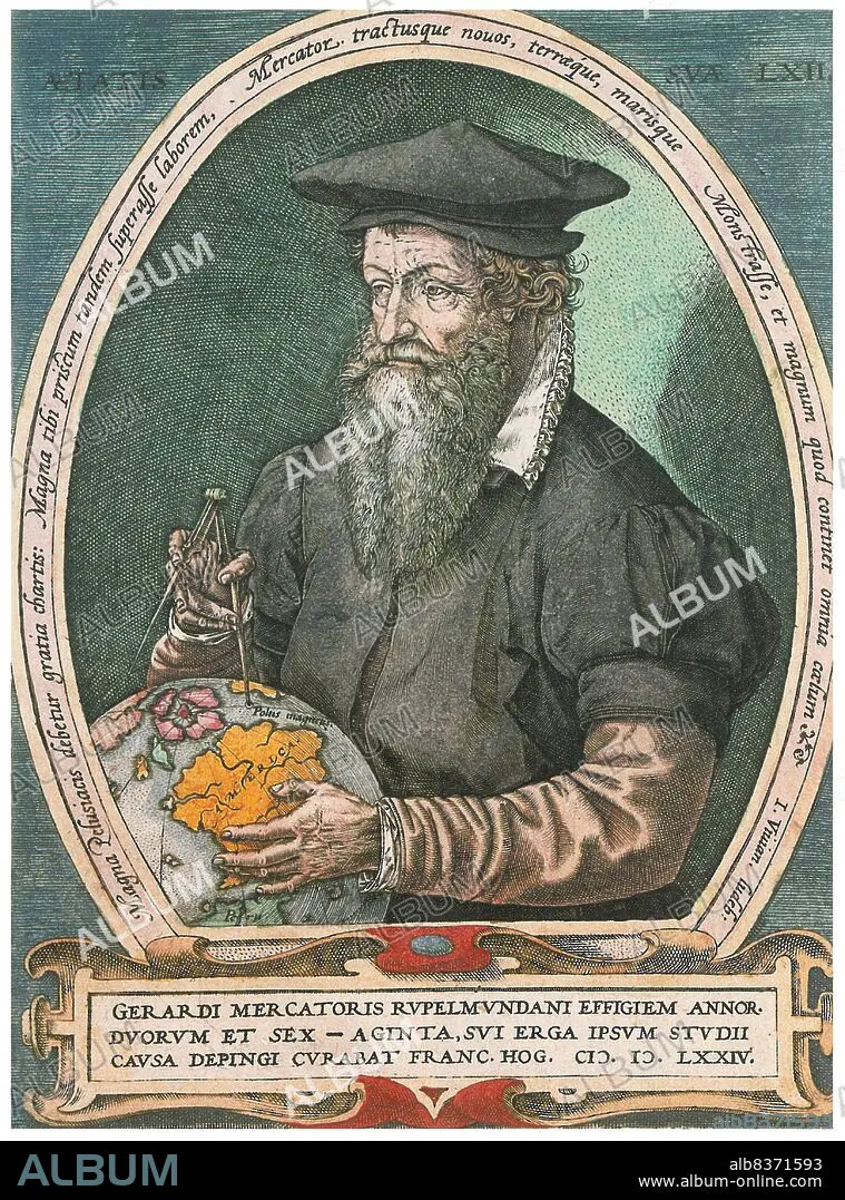
Gerardus Mercator, a Flemish German (5 March 1512 2 December 1594) was a cartographer renowned for creating a world map based on a new projection which represented sailing courses of constant bearing as straight linesan innovation that is still employed in nautical charts used for navigation.
. In his own day he was the world's most famous geographer but, in addition, he had interests in theology, philosophy, history, mathematics and magnetism as well as being an accomplished engraver, calligrapher and maker of globes and scientific instruments.
Crédito: Album / Universal Images Group / Pictures From History
Autorizaciones: ? Cesión de modelo: No - ? Cesión de propiedad: No
¿Preguntas relacionadas con los derechos?
¿Preguntas relacionadas con los derechos?
Tamaño imagen: 3259 × 4396 px | 41.0 MB
Tamaño impresión: 27.6 × 37.2 cm | 1283.1 × 1730.7 in (300 dpi)
