alb3960228
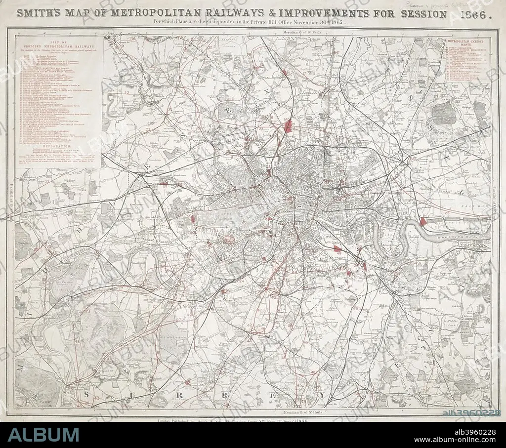
Map of Greater London showing the Metropolitan Railways and improvements in 1866. Artist: Anon
| Compartir |
|---|
 Pinterest Pinterest |
 Twitter Twitter |
 Facebook Facebook |
 Copiar enlace Copiar enlace |
 Email Email |
|
Añadir a otro lightbox |
|
Añadir a otro lightbox |


¿Ya tienes cuenta? Iniciar sesión
¿No tienes cuenta? Regístrate
Compra esta imagen

Título:
Map of Greater London showing the Metropolitan Railways and improvements in 1866. Artist: Anon
Descripción:
Ver traducción automática
Map of Greater London showing the Metropolitan Railways and improvements in 1866. With a table inset listing the proposed lines. Completed railways are shown in a firm black line, with those in progress or sanctioned represented by a pecked black line. Proposed new lines are shown in red.
Personas:
Crédito:
Album / The London Archives (City of London)/Heritage Images
Autorizaciones:
Modelo: No - Propiedad: No
¿Preguntas relacionadas con los derechos?
¿Preguntas relacionadas con los derechos?
Tamaño imagen:
2747 x 2290 px | 18.0 MB
Tamaño impresión:
23.3 x 19.4 cm | 9.2 x 7.6 in (300 dpi)
Palabras clave:
ANONIMA • ANONIMO • CIUDAD • COLOR • EPOCA VICTORIANA • FERROCARRIL • GUILDHALL LIBRARY & ART GALLERY • INGLATERRA • LITOGRAFIA • LONDRES • MAPA • PLAN • SIGLO XIX • SIGLO • TRANSPORTE PUBLICO • TRANSPORTE • VICTORIANO
